MyTopo
Coleman NE Michigan US Topo Map
Couldn't load pickup availability
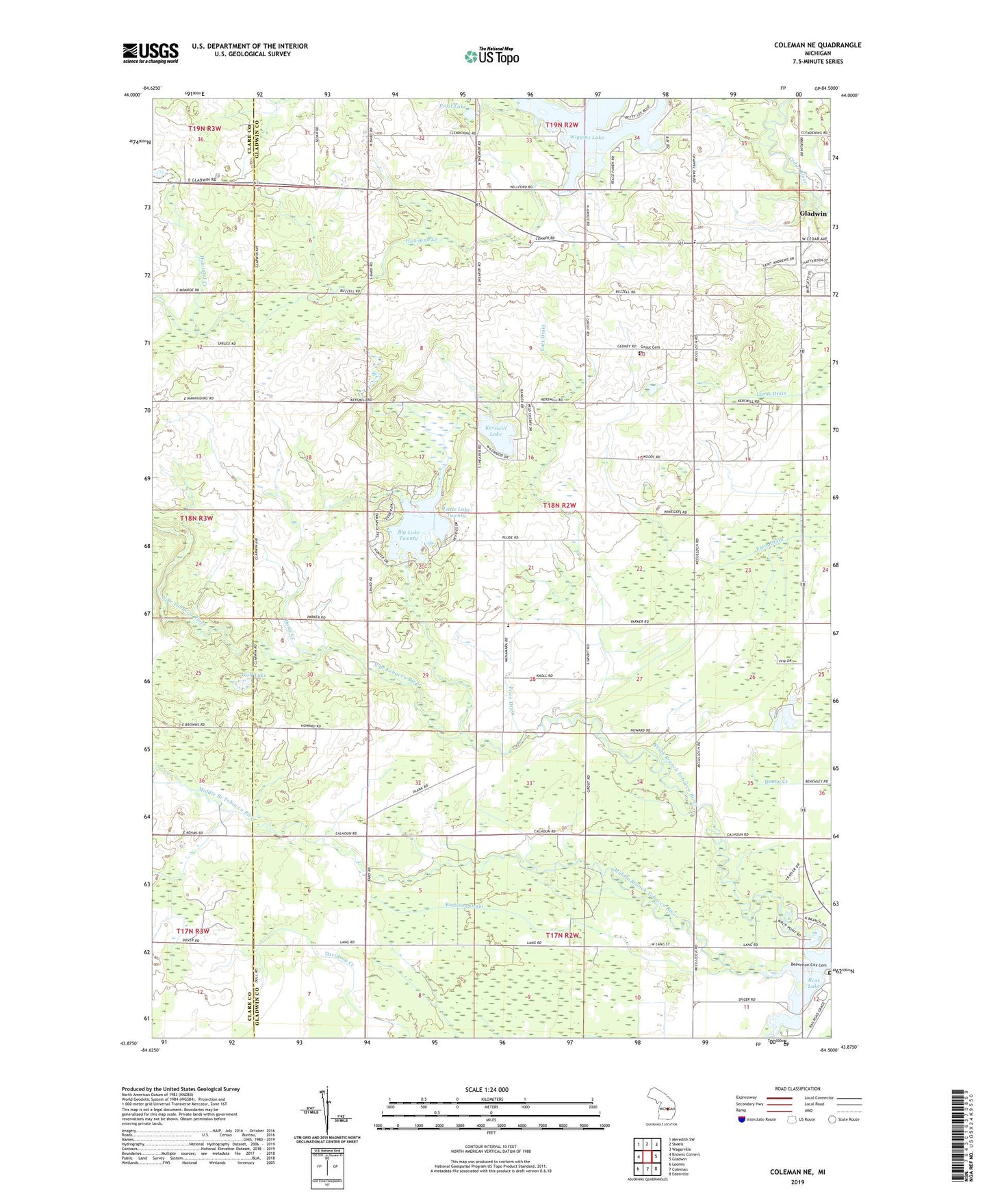
2019 topographic map quadrangle Coleman NE in the state of Michigan. Scale: 1:24000. Based on the newly updated USGS 7.5' US Topo map series, this map is in the following counties: Gladwin, Clare. The map contains contour data, water features, and other items you are used to seeing on USGS maps, but also has updated roads and other features. This is the next generation of topographic maps. Printed on high-quality waterproof paper with UV fade-resistant inks.
Quads adjacent to this one:
West: Browns Corners
Northwest: Meredith SW
North: Skeels
Northeast: Wagarville
East: Gladwin
Southeast: Edenville
South: Coleman
Southwest: Loomis
Contains the following named places: Assembly of God Church, Bard Post Office, Beaverton City Cemetery, Big Lake Twenty, Burleson Drain, Calhoun Campground, Carr Drain, Christ the King Lutheran Church, First United Methodist Church, Frost Lake, Gladwin Heights Golf Course, Grout Cemetery, Grout Oil Field, Grout Post Office, Howe Creek, Howland Creek, Kerswill Lake, Lakeview Village Mobile Home Park, Little Lake Twenty, Middle Branch Tobacco River, North Branch Tobacco River, Price Drain, Saint John the Evangelical Lutheran Church, South Branch Tobacco River, Township of Grout, West Grout Church, WGDN-AM (Gladwin), WGDN-FM (Gladwin), Wheatley Post Office, Wiggins Lake, WMRX-FM (Beaverton), Wolf Lake