MyTopo
Wagarville Michigan US Topo Map
Couldn't load pickup availability
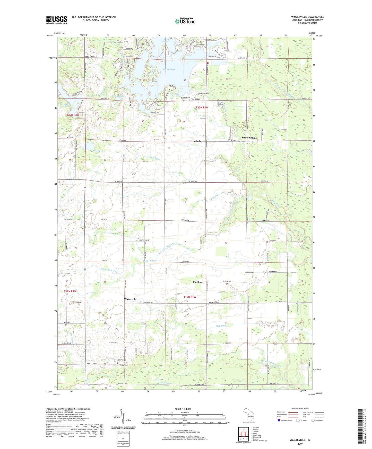
2023 topographic map quadrangle Wagarville in the state of Michigan. Scale: 1:24000. Based on the newly updated USGS 7.5' US Topo map series, this map is in the following counties: Gladwin. The map contains contour data, water features, and other items you are used to seeing on USGS maps, but also has updated roads and other features. This is the next generation of topographic maps. Printed on high-quality waterproof paper with UV fade-resistant inks.
Quads adjacent to this one:
West: Skeels
Northwest: Meredith
North: Butman
Northeast: Edwards
East: Secord Lake
Southeast: Wooden Shoe Village
South: Gladwin
Southwest: Coleman NE
This map covers the same area as the classic USGS quad with code o44084a4.
Contains the following named places: Bendle Drain, Bennington Drain, Butman Township Fire Department, Gladwin Township Hall, Grass Lake, Hockaday, Hockaday Community Church, Hockaday Post Office, Humanson Drain, Hummerson Lake, Jehovah's Witnesses, Lake Lancelot, Lake Lancer, Lake Lochbrae, Long Drain, Long Lake Church, Long Lake Creek, McClure, McClure Cemetery, McClure Church, McClure Post Office, Miracle Mission, New Hope Free Methodist Church, Nineteen Lake, Ogg Drain, Ridge Cemetery, Round Lake, Sacred Heart Cemetery, Shell Drain, South Branch Little Sugar River, Sugar Rapids, Sugar Rapids Post Office, Township of Butman, Township of Gladwin, Wagarville, Wagerville United Methodist Church, Weir Drain, Wheeler Drain, ZIP Code: 48624