MyTopo
Edenville Michigan US Topo Map
Couldn't load pickup availability
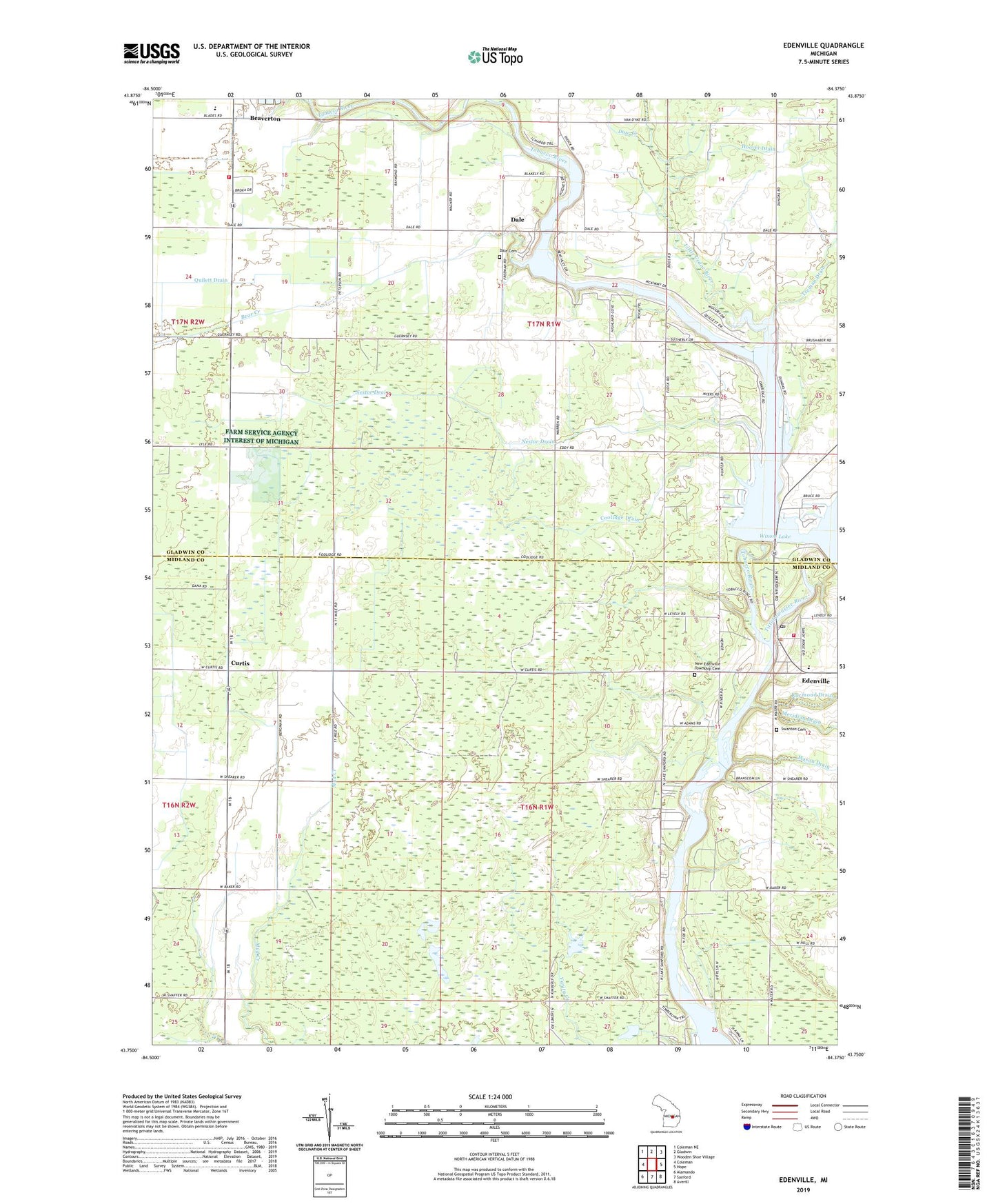
2023 topographic map quadrangle Edenville in the state of Michigan. Scale: 1:24000. Based on the newly updated USGS 7.5' US Topo map series, this map is in the following counties: Midland, Gladwin. The map contains contour data, water features, and other items you are used to seeing on USGS maps, but also has updated roads and other features. This is the next generation of topographic maps. Printed on high-quality waterproof paper with UV fade-resistant inks.
Quads adjacent to this one:
West: Coleman
Northwest: Coleman NE
North: Gladwin
Northeast: Wooden Shoe Village
East: Hope
Southeast: Averill
South: Sanford
Southwest: Alamando
This map covers the same area as the classic USGS quad with code o43084g4.
Contains the following named places: Bear Creek, Beaverton Area Fire Department, Beaverton Baptist Church, Beaverton Church of God, Beaverton High School, Coolidge Drain, Crockett Drain, Curtice Post Office, Curtis, Dale, Dale Cemetery, Dale Post Office, Dale United Methodist Church, Dow Creek, Edenville, Edenville Dam, Edenville Post Office, Edenville Township Fire and Rescue Station 1, Edenville United Methodist Church, Good Shepherd Lutheran Church, Hoover Drain, Little Cedar River, Mason Drain, Nestor Drain, New Edenville Township Cemetery, Otgen Drain, Quilett Drain, Saint Anne Church, Seventh Day Adventist Church, Seventh-Day Adventist School, Snyder Drain, Swanton Cemetery, Tittabawassee River State Forest, Tobacco River, Tobacco River Campground, Township of Edenville, Township of Tobacco, Treman Drain, Wrights, Wright's Bridge Post Office