
MyTopo
Curtis West Michigan US Topo Map
Couldn't load pickup availability
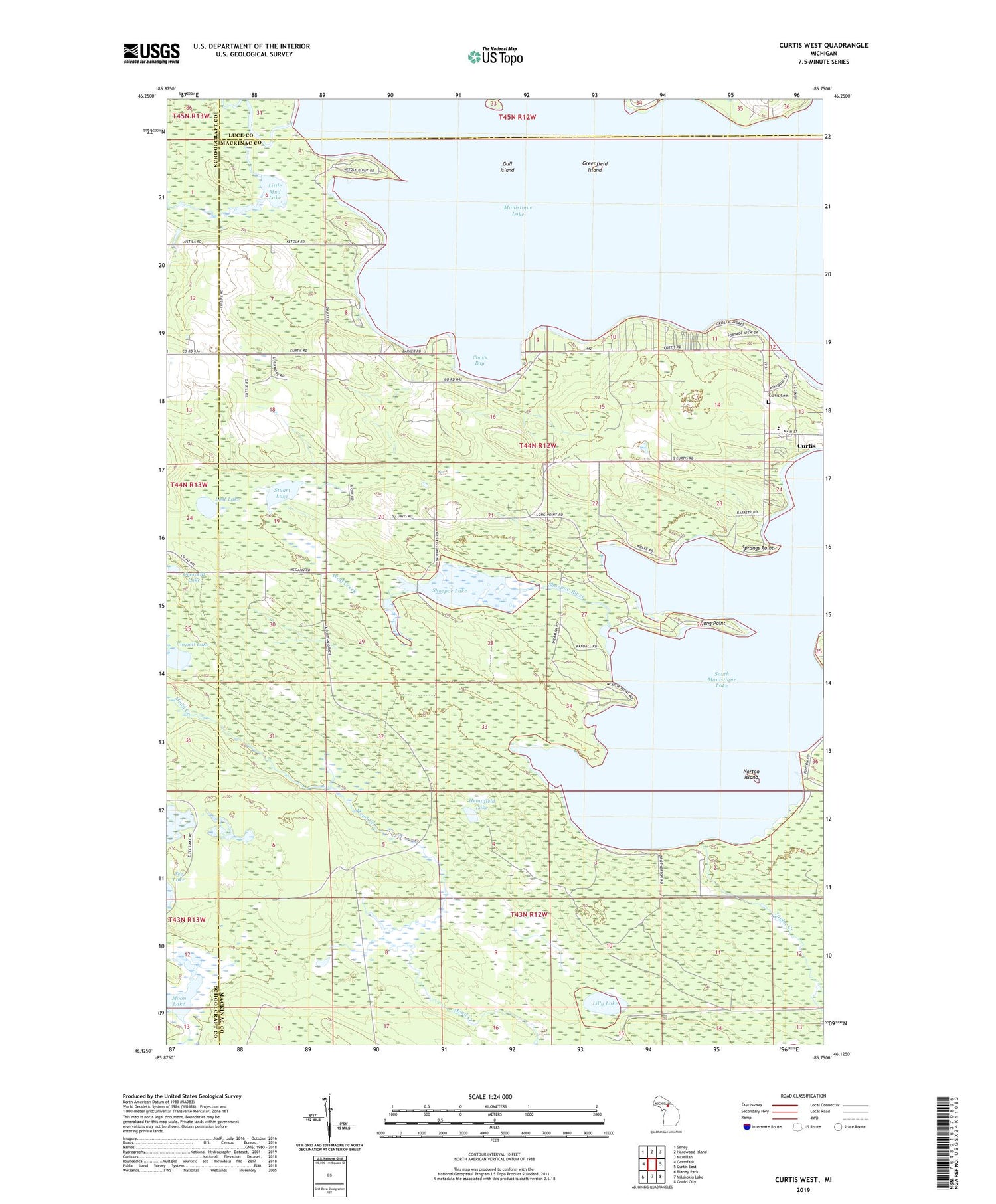
2019 topographic map quadrangle Curtis West in the state of Michigan. Scale: 1:24000. Based on the newly updated USGS 7.5' US Topo map series, this map is in the following counties: Mackinac, Schoolcraft, Luce. The map contains contour data, water features, and other items you are used to seeing on USGS maps, but also has updated roads and other features. This is the next generation of topographic maps. Printed on high-quality waterproof paper with UV fade-resistant inks.
Quads adjacent to this one:
West: Germfask
Northwest: Seney
North: Hardwood Island
Northeast: McMillan
East: Curtis East
Southeast: Gould City
South: Milakokia Lake
Southwest: Blaney Park
Contains the following named places: Blue Heron Golf Course, Cooks Bay, Cornell Lake, Crescent Lake, Curtis Cemetery, Curtis Elementary School, Curtis Park, Diller Post Office, Foster Island, Greenfield Island, Gull Island, Hempfield Lake, Lilly Lake, Little Mud Lake, Long Point, Lost Lake, Manistique Lake, Moon Lake, Norton Creek, Norton Island, Portage Township Community Recreation Area, Shoepac Lake, Shoepac River, South Manistique Lake, South Manistique Lake Campground, Sprangs Point, Stuart Lake, Taylor Creek, Wolf Creek


