MyTopo
Deerfield Michigan US Topo Map
Couldn't load pickup availability
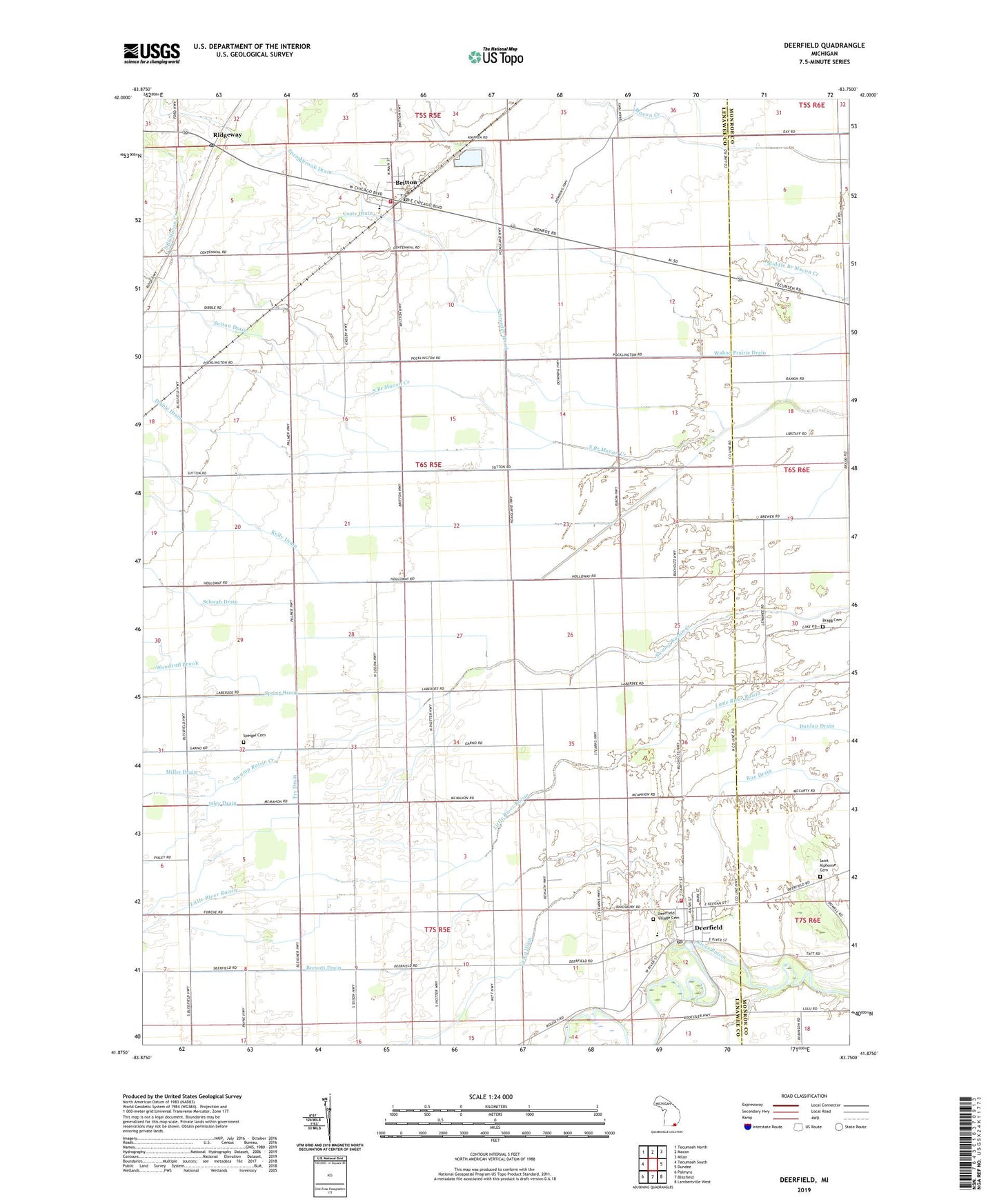
2023 topographic map quadrangle Deerfield in the state of Michigan. Scale: 1:24000. Based on the newly updated USGS 7.5' US Topo map series, this map is in the following counties: Lenawee, Monroe. The map contains contour data, water features, and other items you are used to seeing on USGS maps, but also has updated roads and other features. This is the next generation of topographic maps. Printed on high-quality waterproof paper with UV fade-resistant inks.
Quads adjacent to this one:
West: Tecumseh South
Northwest: Tecumseh North
North: Macon
Northeast: Milan
East: Dundee
Southeast: Lambertville West
South: Blissfield
Southwest: Palmyra
This map covers the same area as the classic USGS quad with code o41083h7.
Contains the following named places: Brablec Farms Airport, Brenott Drain, Britton, Britton Bethel Baptist Church, Britton Fire Department, Britton Library, Britton Post Office, Britton Station, Camp Drain, Coats Drain, Congregational Christian Church, Deerfield, Deerfield Post Office, Deerfield Public School, Deerfield Station, Deerfield Township Fire Department, Deerfield United Methodist Church, Deerfield Village Cemetery, Dibble Drain, Free Methodist Church, Fry Drain, Grace Church, Immanuels Church, Isley Drain, Kelly Drain, Leib Cemetery, Miller Drain, Pentecostal Church of God, Ridgeway, Ridgeway Baptist Church, Ridgeway Church of the Nazarene, Ridgeway Post Office, Ridgeway Station, Ridgeway Township Fire Department, Ridgeway Township Hall, Roberts Ingold Library, Saint Alphonsus Cemetery, Saint Alphonsus Church, Schreeder Brook, Schwab Drain, Speigel Cemetery, Spring Brook, Springbrook Drain, Sutton Drain, Township of Deerfield, Township of Ridgeway, Village of Britton, Village of Deerfield, Woodruff Brook, ZIP Codes: 49229, 49238