MyTopo
Tecumseh South Michigan US Topo Map
Couldn't load pickup availability
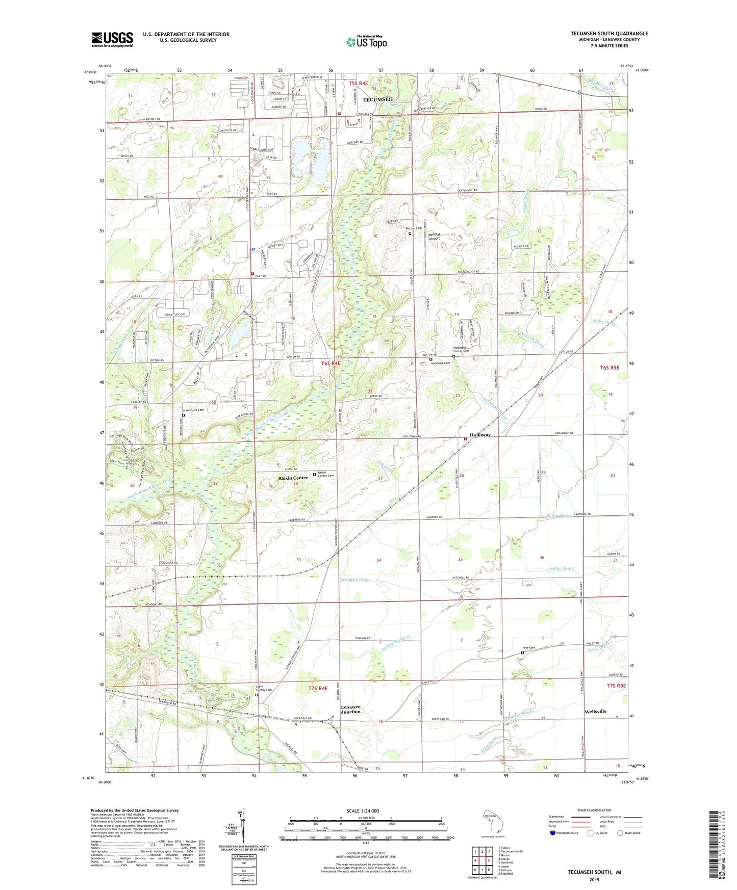
2023 topographic map quadrangle Tecumseh South in the state of Michigan. Scale: 1:24000. Based on the newly updated USGS 7.5' US Topo map series, this map is in the following counties: Lenawee. The map contains contour data, water features, and other items you are used to seeing on USGS maps, but also has updated roads and other features. This is the next generation of topographic maps. Printed on high-quality waterproof paper with UV fade-resistant inks.
Quads adjacent to this one:
West: Adrian
Northwest: Tipton
North: Tecumseh North
Northeast: Macon
East: Deerfield
Southeast: Blissfield
South: Palmyra
Southwest: Jasper
This map covers the same area as the classic USGS quad with code o41083h8.
Contains the following named places: Ash Drain, Cal Zorn Recreation Complex, Chase's Station, Clark Family Cemetery, Cook Drain, Frye Cemetery, Hazelbank Cemetery, Holdridge Family Cemetery, Holloway, Holloway Cemetery, Holloway Post Office, Holloway Station, Holy Family Clinic, Lenawee Junction, Lenawee Junction Post Office, Lenawee Junction Station, Lenawee Seventh-Day Adventist School, Mc Lain Cemetery, Merillat Airport, Mitchell Park, Pope Drain, Raisin Center, Raisin Center Church, Raisin Center Friends Cemetery, Raisin Center Post Office, Raisin Presbyterian Church, Raisin Township Fire Department, Raisin Township Fire Department Annex, Raisin Township Police Department, Raisin Valley Golf Course, South Branch River Raisin, Sulton Station, Sutton Post Office, Tecumseh Acres Elementary School, Tecumseh Fire Department, Tecumseh Free Will Baptist Church, Tecumseh Park, Tecumseh Seventh-Day Adventist Church, Tecumseh South Early Learning Center, Township of Raisin, Wellsville, Wellsville United Methodist Church, Westgate Drain, WLEN-FM (Adrian)