MyTopo
Hope Michigan US Topo Map
Couldn't load pickup availability
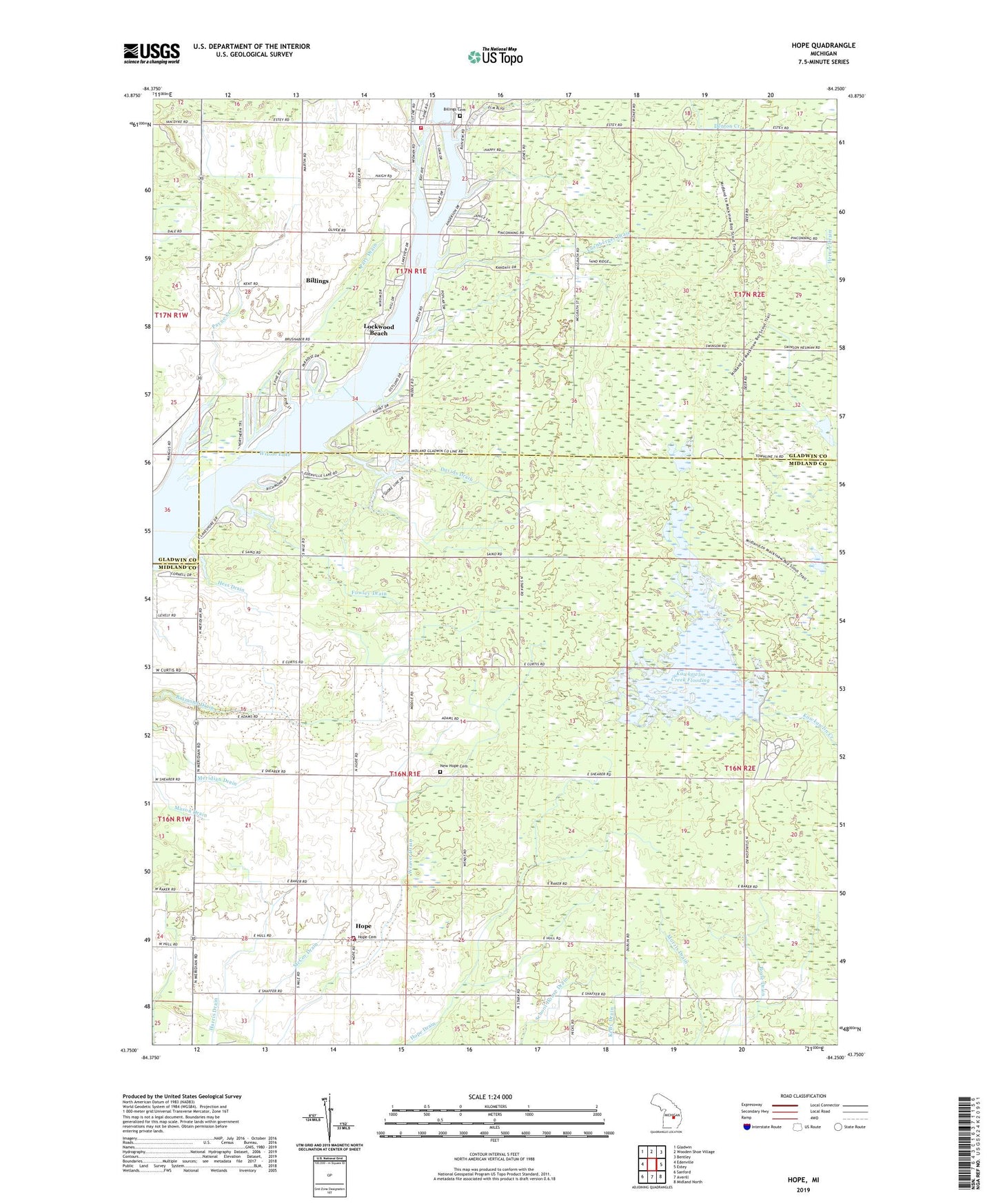
2023 topographic map quadrangle Hope in the state of Michigan. Scale: 1:24000. Based on the newly updated USGS 7.5' US Topo map series, this map is in the following counties: Midland, Gladwin. The map contains contour data, water features, and other items you are used to seeing on USGS maps, but also has updated roads and other features. This is the next generation of topographic maps. Printed on high-quality waterproof paper with UV fade-resistant inks.
Quads adjacent to this one:
West: Edenville
Northwest: Gladwin
North: Wooden Shoe Village
Northeast: Bentley
East: Estey
Southeast: Midland North
South: Averill
Southwest: Sanford
This map covers the same area as the classic USGS quad with code o43084g3.
Contains the following named places: All Bright Shores, Billings, Billings Cemetery, Billings Missionary Church, Billings Post Office, Billings Township Fire Department, Billings Township Hall, Davids Drain, Denton Creek, Fowley Drain, Gully Golf Course, Harris Drain, Hess Drain, Hillside School, Hope, Hope Baptist Church, Hope Cemetery, Hope Drain, Hope Post Office, Hope Township Fire Department, Hope United Methodist Church, Kawkawlin Creek Flooding, Living Hope Fellowship Church, Lockwood Beach, Luenberger Drain, McCoy Drain, Meridian Drain, Morris Drain, New Hope Cemetery, New Hope Community Church of God, Ortner Drain, Pary Drain, Payne Creek, Pleasant Beach Mobile Home Park, Raymond Drain, Township of Billings, Township of Hope, Weaver Drain, Wixom Lake, Woodby Drain, ZIP Code: 48628