MyTopo
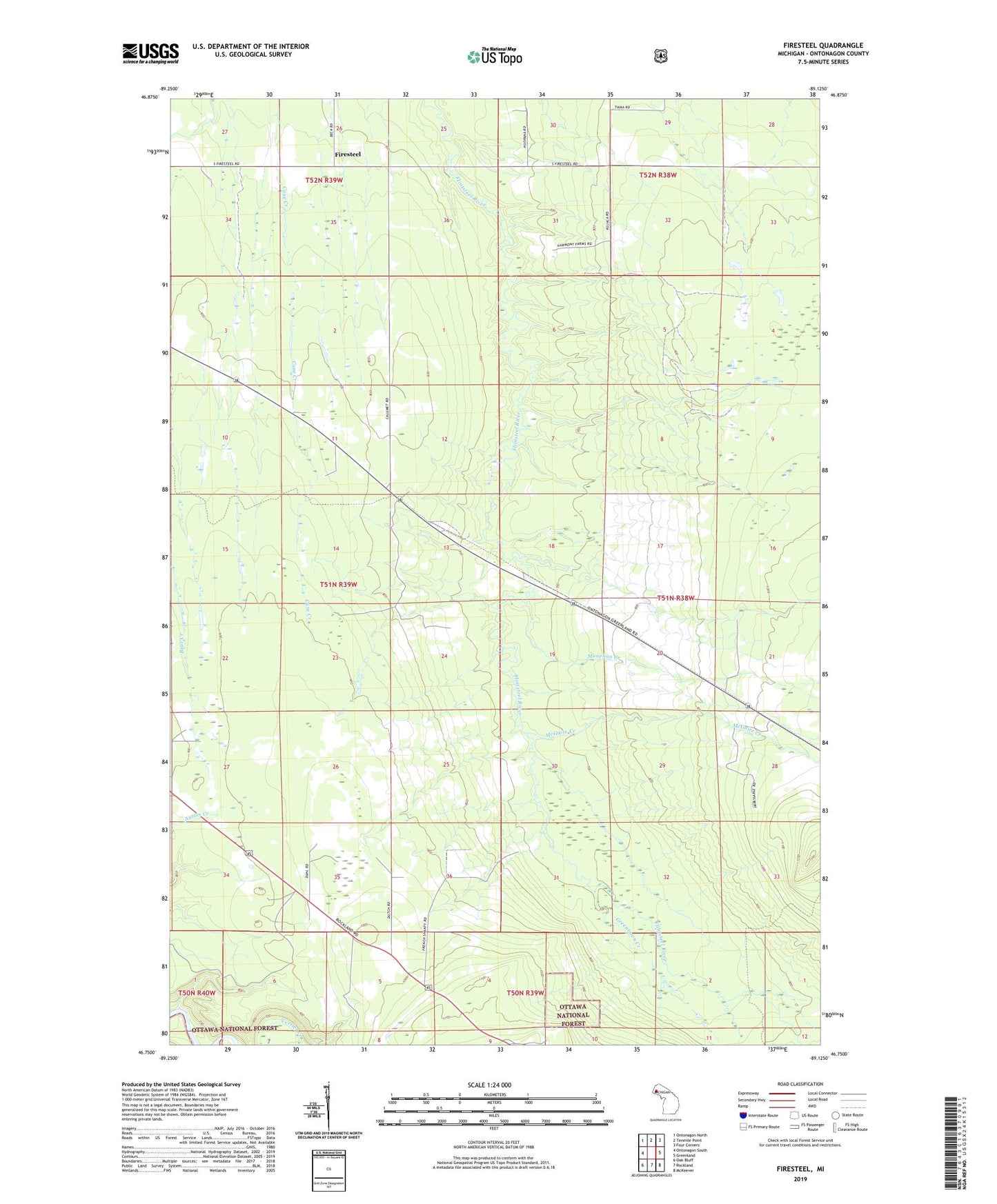
Firesteel Michigan US Topo Map
Couldn't load pickup availability
Also explore the Firesteel Forest Service Topo of this same quad for updated USFS data
2023 topographic map quadrangle Firesteel in the state of Michigan. Scale: 1:24000. Based on the newly updated USGS 7.5' US Topo map series, this map is in the following counties: Ontonagon. The map contains contour data, water features, and other items you are used to seeing on USGS maps, but also has updated roads and other features. This is the next generation of topographic maps. Printed on high-quality waterproof paper with UV fade-resistant inks.
Quads adjacent to this one:
West: Ontonagon South
Northwest: Ontonagon North
North: Tenmile Point
Northeast: Four Corners
East: Greenland
Southeast: McKeever
South: Rockland
Southwest: Oak Bluff
This map covers the same area as the classic USGS quad with code o46089g2.
Contains the following named places: Caledonia Creek, Camp 4, Firesteel, Greentown Creek, McGuire Creek, Monehan Creek, Seventh Day Adventist Church, ZIP Code: 49929