MyTopo
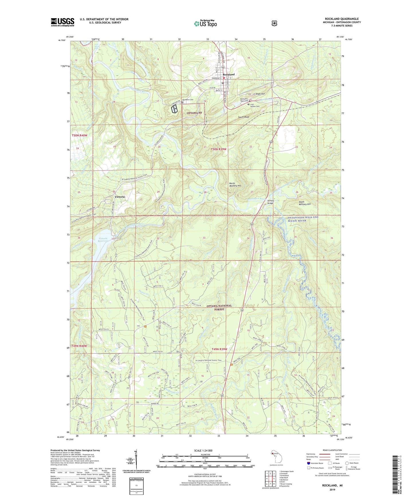
Rockland Michigan US Topo Map
Couldn't load pickup availability
Also explore the Rockland Forest Service Topo of this same quad for updated USFS data
2023 topographic map quadrangle Rockland in the state of Michigan. Scale: 1:24000. Based on the newly updated USGS 7.5' US Topo map series, this map is in the following counties: Ontonagon. The map contains contour data, water features, and other items you are used to seeing on USGS maps, but also has updated roads and other features. This is the next generation of topographic maps. Printed on high-quality waterproof paper with UV fade-resistant inks.
Quads adjacent to this one:
West: Oak Bluff
Northwest: Ontonagon South
North: Firesteel
Northeast: Greenland
East: McKeever
Southeast: Paynesville
South: Bruce Crossing
Southwest: Ewen
This map covers the same area as the classic USGS quad with code o46089f2.
Contains the following named places: Baltimore River, C Shaft Hill, Childhood Cottage Museum, Cushman Creek, Deer Lick Creek, East Branch Ontonagon River, Erickson Creek, Irish Hollow Cemetery, Irish Rapid Falls, Lane Creek, Methodist Rose Cemetery, Middle Branch Ontonagon River, Military Bridge, North Country National Scenic Trail, North Military Hill, O Kun de Kun Falls, Old Indian Burial Grounds, Old Victoria Historic Townsite, Patty Creek, Plover Creek, Rockland, Rockland Census Designated Place, Rockland Creek, Rockland Post Office, Rockland Station, Rockland Township Library, Rockland Volunteer Fire Department, Saint Mary's Church, Sandstone Creek, South Bluff, South Military Hill, Spring Creek, Sucker Creek, Township of Rockland, Verrier Creek, Victoria, Victoria Dam, Victoria Post Office, Victoria Reservoir, West Branch Ontonagon River, Woodawn Cemetery, WUPY-FM (Ontonagon)