MyTopo
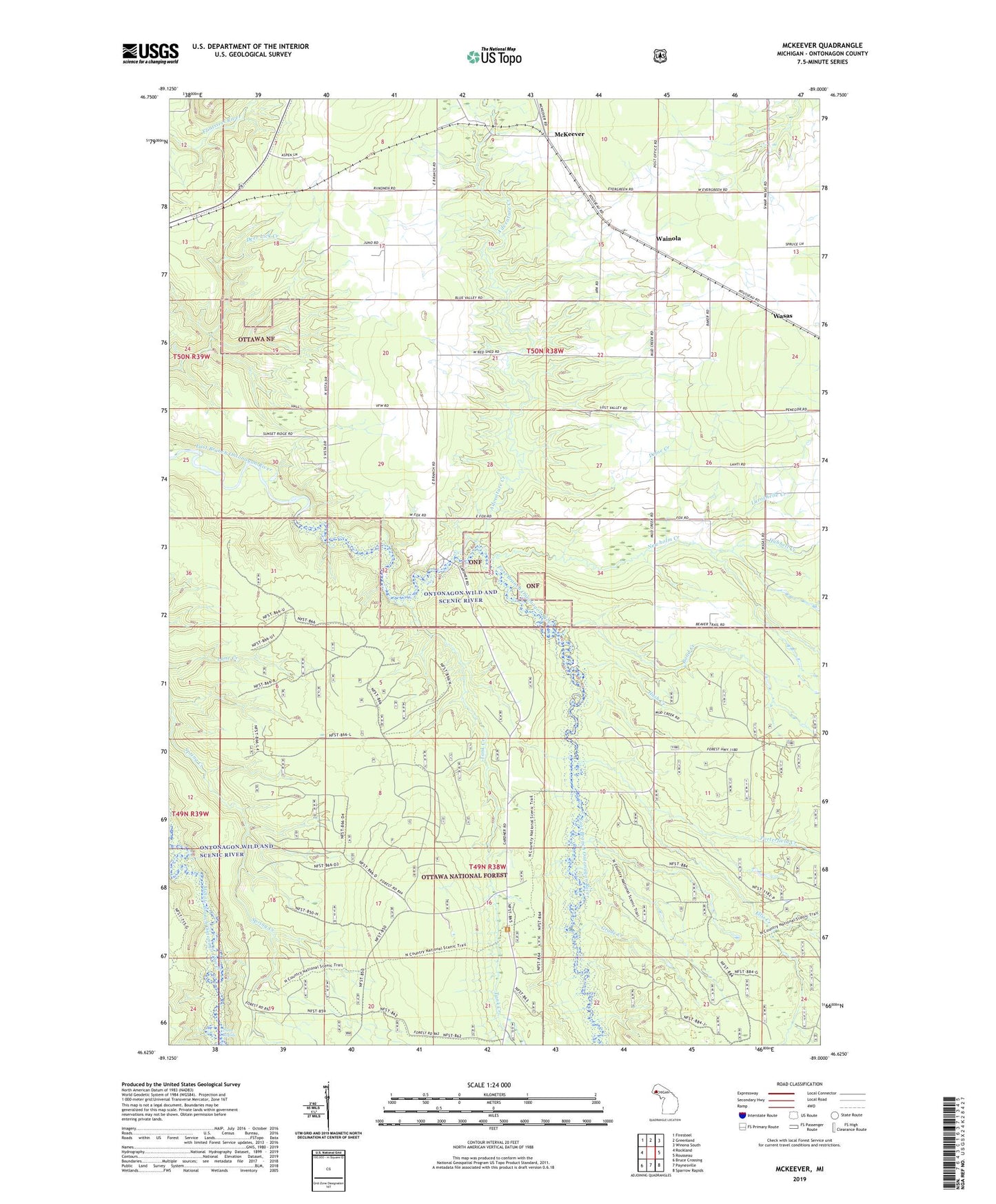
McKeever Michigan US Topo Map
Couldn't load pickup availability
Also explore the McKeever Forest Service Topo of this same quad for updated USFS data
2023 topographic map quadrangle McKeever in the state of Michigan. Scale: 1:24000. Based on the newly updated USGS 7.5' US Topo map series, this map is in the following counties: Ontonagon. The map contains contour data, water features, and other items you are used to seeing on USGS maps, but also has updated roads and other features. This is the next generation of topographic maps. Printed on high-quality waterproof paper with UV fade-resistant inks.
Quads adjacent to this one:
West: Rockland
Northwest: Firesteel
North: Greenland
Northeast: Winona South
East: Rousseau
Southeast: Sparrow Rapids
South: Paynesville
Southwest: Bruce Crossing
This map covers the same area as the classic USGS quad with code o46089f1.
Contains the following named places: Adventure Creek, Bond Creek, Defoe Creek, Ellis Creek, Gardner Lookout Tower, Grade Creek, Hash Creek, Hubbell Creek, Larochelle Creek, Mass Station, McKeever, Newholm Creek, Porterfield Creek, Stew Creek, Tank Creek, Wainola, Wainola Church, Wainola Post Office, Wainola Station, Wasas, ZIP Code: 49948