
MyTopo
Garden Corners Michigan US Topo Map
Couldn't load pickup availability
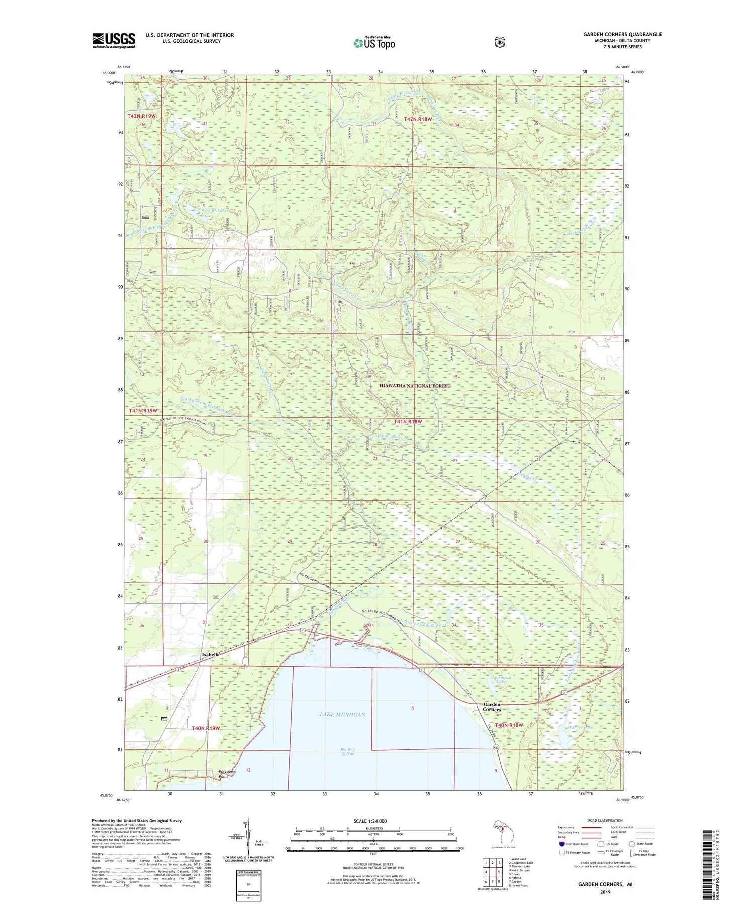
2019 topographic map quadrangle Garden Corners in the state of Michigan. Scale: 1:24000. Based on the newly updated USGS 7.5' US Topo map series, this map is in the following counties: Delta. The map contains contour data, water features, and other items you are used to seeing on USGS maps, but also has updated roads and other features. This is the next generation of topographic maps. Printed on high-quality waterproof paper with UV fade-resistant inks.
Quads adjacent to this one:
West: Saint Jacques
Northwest: Waco Lake
North: Gooseneck Lake
Northeast: Thunder Lake
East: Cooks
Southeast: Hiram Point
South: Garden
Southwest: Nahma
Contains the following named places: Archambeau Creek, Bethany Church, Camp Eleven Creek, Camp Seven Creek, Camp Twelve Creek, Cousineau Lake, Fish Dam Campground and RV Park, Fishdam Park, Fishdam River, Garden Corners, Garden Corners Rest Area, Isabella, Isabella Post Office, Isabella Station, Little Fishdam River, McIgee Creek, Porcupine Point, Saint Ann Church, Southwest Branch Fishdam River, Spring Creek, Township of Garden, Vans Camp, Warner Lake, West Branch Lakes


