MyTopo
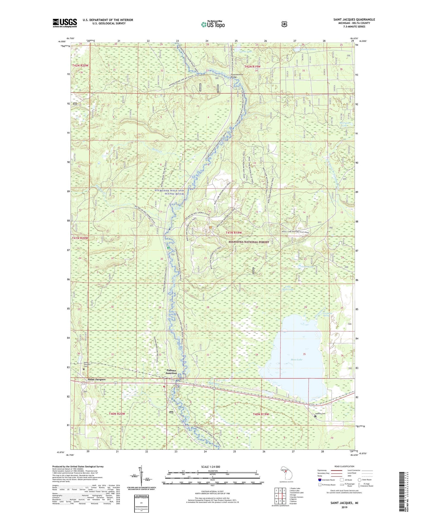
Saint Jacques Michigan US Topo Map
Couldn't load pickup availability
Also explore the Saint Jacques Forest Service Topo of this same quad for updated USFS data
2023 topographic map quadrangle Saint Jacques in the state of Michigan. Scale: 1:24000. Based on the newly updated USGS 7.5' US Topo map series, this map is in the following counties: Delta. The map contains contour data, water features, and other items you are used to seeing on USGS maps, but also has updated roads and other features. This is the next generation of topographic maps. Printed on high-quality waterproof paper with UV fade-resistant inks.
Quads adjacent to this one:
West: Ensign
Northwest: Poplar Lake
North: Waco Lake
Northeast: Gooseneck Lake
East: Garden Corners
Southeast: Garden
South: Nahma
Southwest: Ogontz
This map covers the same area as the classic USGS quad with code o45086h6.
Contains the following named places: Bourgois Lake, Cache Lake, Coolaw Lakes, Flowing Well, Flowing Well Campground, Fourteenmile Bridge, Germaine Creek, Germaine Spring, Isabella Cemetery, Little Lake, Little Moss Lake, Mormon Creek, Mormon Creek Picnic Grounds, Moses Creek, Moss Lake, Moss Lake Lookout Tower, Nahma Junction, Nahma Township Volunteer Fire Department, Saint Jacques, Saint Jacques' Cemetery, Saint Jacques Station, Saint Joseph's Post Office, Sturgeon Wild and Scenic River, Tenmile Creek, Tenmile Rapids, Township of Nahma, Tri - Star Emergency Medical Services Station 2