
MyTopo
Glitter Lake Michigan US Topo Map
Couldn't load pickup availability
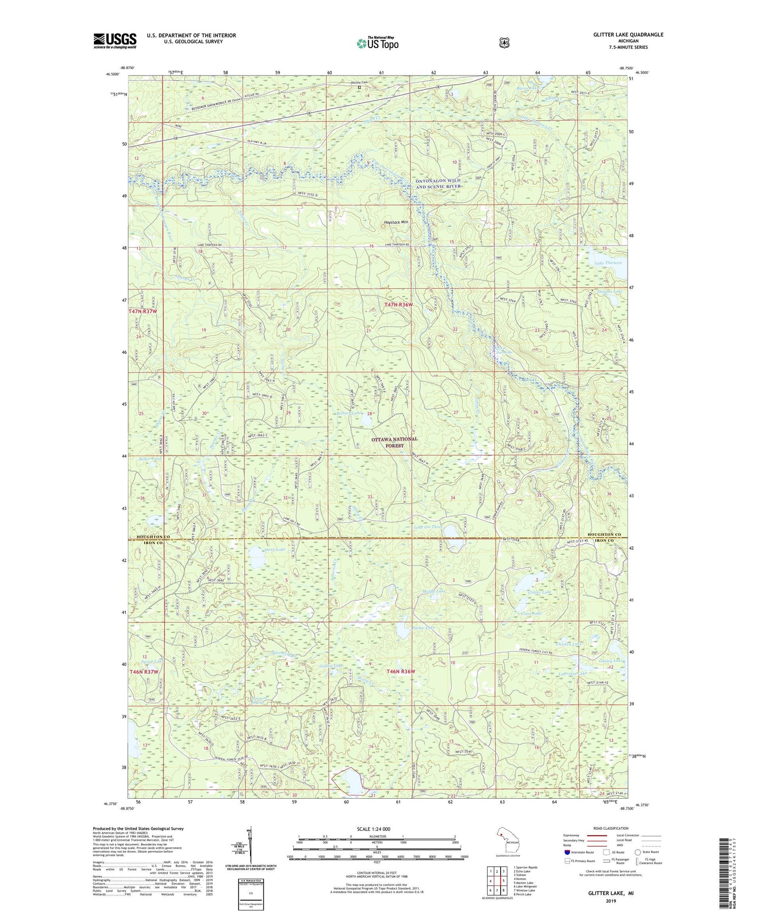
2019 topographic map quadrangle Glitter Lake in the state of Michigan. Scale: 1:24000. Based on the newly updated USGS 7.5' US Topo map series, this map is in the following counties: Houghton, Iron. The map contains contour data, water features, and other items you are used to seeing on USGS maps, but also has updated roads and other features. This is the next generation of topographic maps. Printed on high-quality waterproof paper with UV fade-resistant inks.
Quads adjacent to this one:
West: Kenton
Northwest: Sparrow Rapids
North: Echo Lake
Northeast: Sidnaw
East: Marten Lake
Southeast: Perch Lake
South: Winslow Lake
Southwest: Lake Mitigwaki
Contains the following named places: Antoine Creek, Beitner Lake, Beller Pond, Burns Lake, Chicken Lake, Dunn Creek, Dunn Lake, Gabbit Lake, Gasley Lake, Glare Lake, Glitter Creek, Glitter Lake, Haystack Mountain, Johns Creek, Kitchi Post Office, Kitchi Station, Kitchie Cemetery, LaCrosse Lake, Lake On-Three, Lake Thirteen, Lake Thirteen Creek, Lower Dam Lake, Lower Dam Lake Campground, Muffle Lake, Papoose Lake, Passmore Creek, Passmore Springs, Pathic Lake, Smith Creek, Spargo Creek, Stony Creek, Syrup Lake, Tepee Lookout Tower, Thomas Lake


