MyTopo
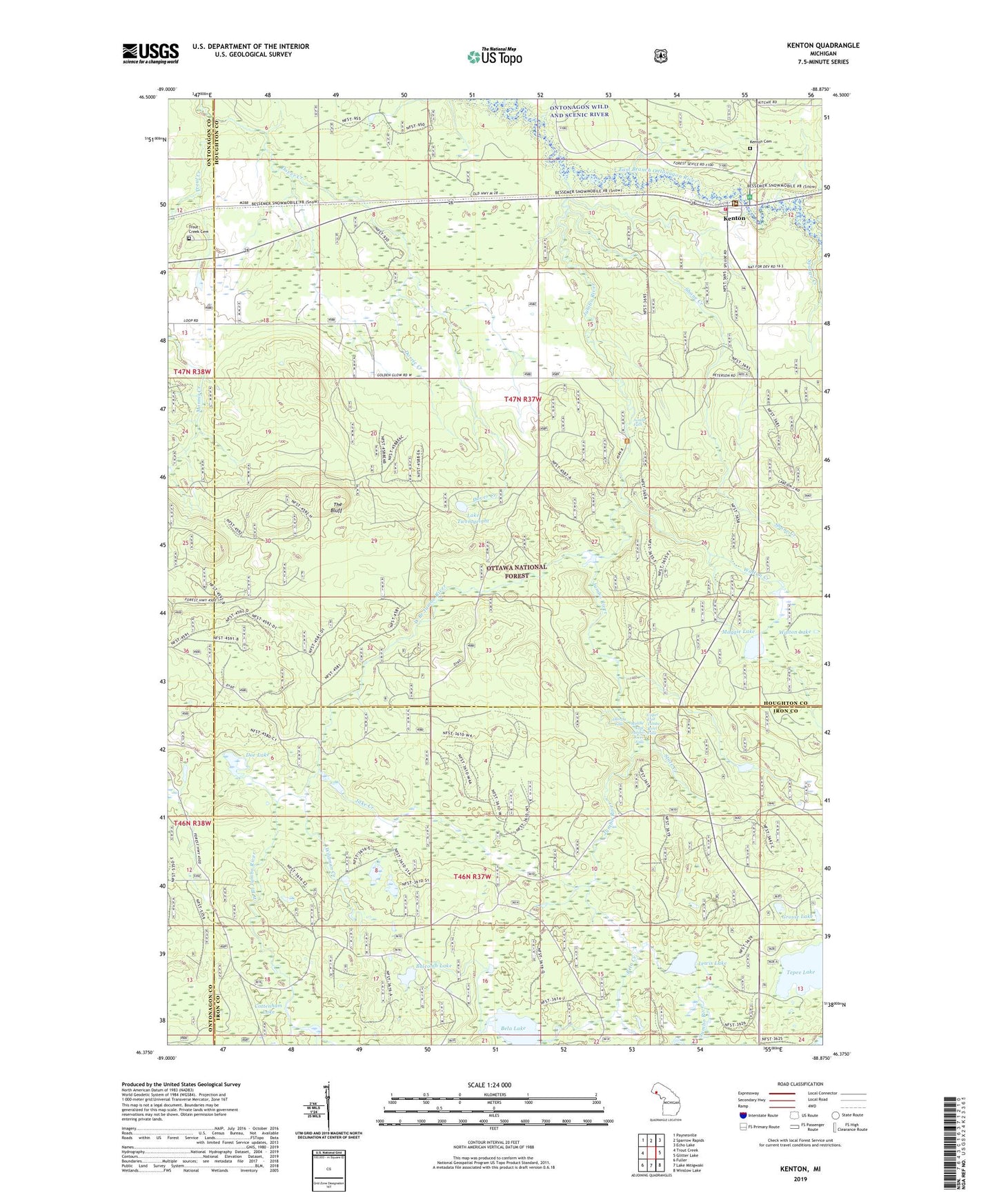
Kenton Michigan US Topo Map
Couldn't load pickup availability
Also explore the Kenton Forest Service Topo of this same quad for updated USFS data
2023 topographic map quadrangle Kenton in the state of Michigan. Scale: 1:24000. Based on the newly updated USGS 7.5' US Topo map series, this map is in the following counties: Houghton, Iron, Ontonagon. The map contains contour data, water features, and other items you are used to seeing on USGS maps, but also has updated roads and other features. This is the next generation of topographic maps. Printed on high-quality waterproof paper with UV fade-resistant inks.
Quads adjacent to this one:
West: Trout Creek
Northwest: Paynesville
North: Sparrow Rapids
Northeast: Echo Lake
East: Glitter Lake
Southeast: Winslow Lake
South: Lake Mitigwaki
Southwest: Fuller
This map covers the same area as the classic USGS quad with code o46088d8.
Contains the following named places: Balcomb Lake, Bela Creek, Bela Lake, Cottenham Lake, Doe Lake, Dorrie Creek, Dover Creek, Dumpy Falls, Duncan Township Fire Department Station 2, Grosse Lake, Jake Creek, Jumbo Falls, Jumbo River, Kenton, Kenton Cemetery, Kenton District Ranger Office, Kenton Post Office, Kenton Station, Lake Twentyeight, Lewis Lake, Maggie Lake, Middle East Jumbo River Falls, Shane Creek, Slate Creek, Sparrow-Kenton Wayside Picnic Area, State Creek, Tepee Lake, Tepee Lake Campground and Picnic Area, The Bluff, Trout Creek Cemetery, Trout Creek Lookout Tower, Upper East Tumbo River Falls, Walton Creek, Walton Lake, West Branch Jumbo River, Wildman Creek