MyTopo
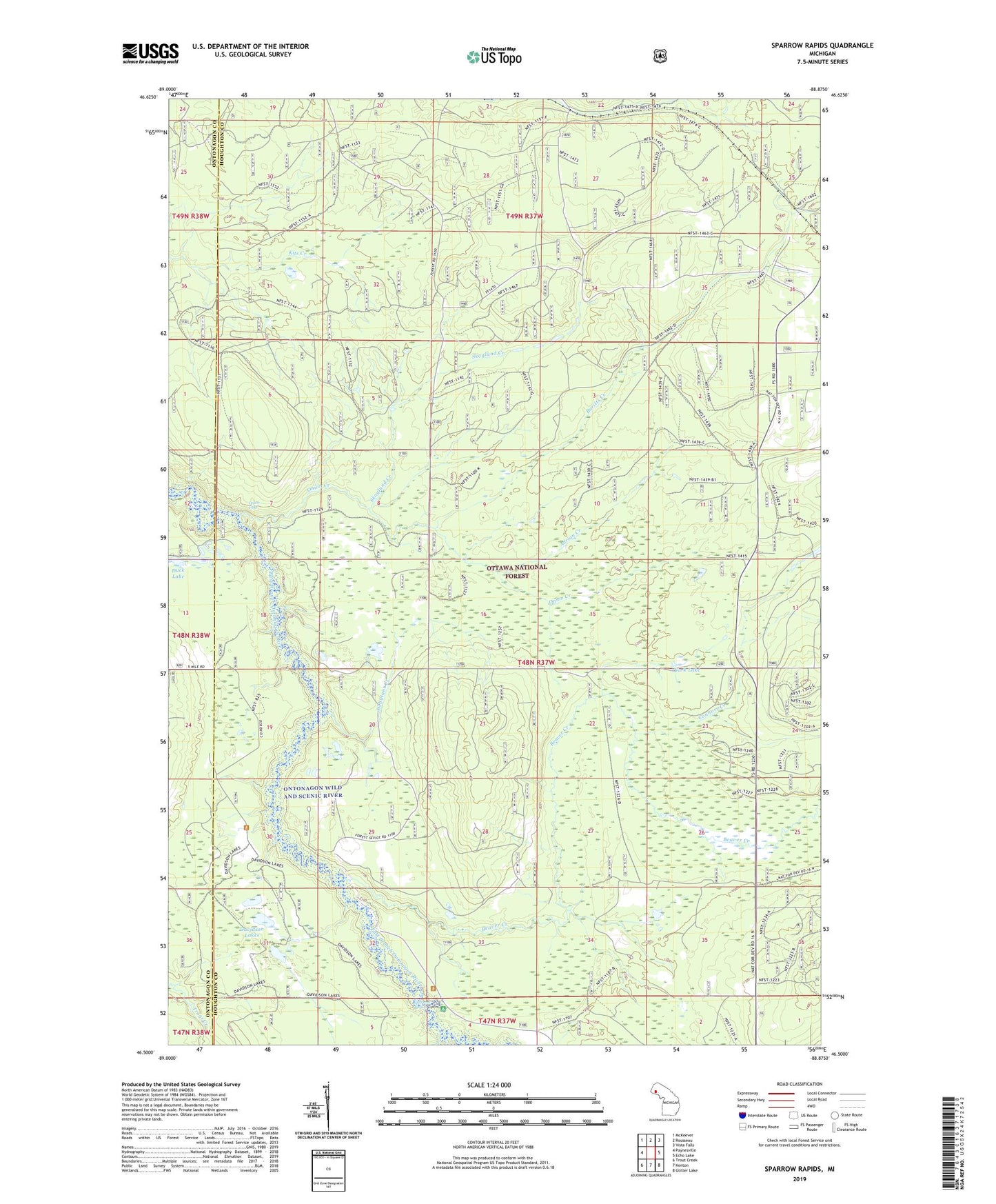
Sparrow Rapids Michigan US Topo Map
Couldn't load pickup availability
Also explore the Sparrow Rapids Forest Service Topo of this same quad for updated USFS data
2023 topographic map quadrangle Sparrow Rapids in the state of Michigan. Scale: 1:24000. Based on the newly updated USGS 7.5' US Topo map series, this map is in the following counties: Houghton, Ontonagon. The map contains contour data, water features, and other items you are used to seeing on USGS maps, but also has updated roads and other features. This is the next generation of topographic maps. Printed on high-quality waterproof paper with UV fade-resistant inks.
Quads adjacent to this one:
West: Paynesville
Northwest: McKeever
North: Rousseau
Northeast: Vista Falls
East: Echo Lake
Southeast: Glitter Lake
South: Kenton
Southwest: Trout Creek
This map covers the same area as the classic USGS quad with code o46088e8.
Contains the following named places: Adrian Creek, Beaver Creek, Brotherton Post Office, Brotherton Station, Buritts Creek, Connors Creek, Connors Lookout Tower, Davidson Lakes, Debutant Creek, Duck Lake, Onion Creek, Onion Falls, Skoglund Creek, Sparrow Rapids, Sparrow Rapids Campground, Townsend Lake, York Lake, ZIP Code: 49967