
MyTopo
Goetzville Michigan US Topo Map
Couldn't load pickup availability
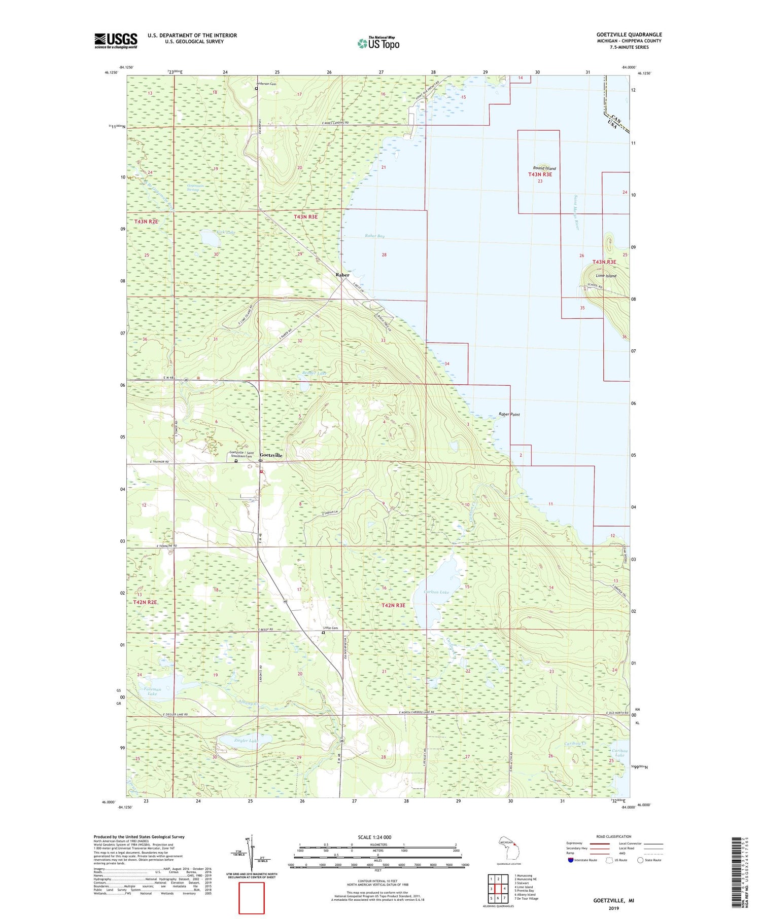
2019 topographic map quadrangle Goetzville in the state of Michigan. Scale: 1:24000. Based on the newly updated USGS 7.5' US Topo map series, this map is in the following counties: Chippewa. The map contains contour data, water features, and other items you are used to seeing on USGS maps, but also has updated roads and other features. This is the next generation of topographic maps. Printed on high-quality waterproof paper with UV fade-resistant inks.
Quads adjacent to this one:
West: Stalwart
Northwest: Munuscong
North: Munuscong NE
East: Lime Island
Southeast: De Tour Village
South: Albany Island
Southwest: Prentiss Bay
Contains the following named places: Anderson Cemetery, Bender Lake, Carlton Creek, Carlton Lake, Foreman Lake, Goetzville, Goetzville / Saint Stanislaus Cemetery, Goetzville Lookout Tower, Goetzville Post Office, Karen's Cabins and Campgrounds, Kirk Lake, Lime Island Channel, Lime Island Post Office, Lime Island State Forest Campground, Little Cemetery, Raber, Raber Bay, Raber Point, Raber Post Office, Raber Township Fire Department, Round Island, Round Island Light, Saint Stanislaus Church, Schlesser Post Office, Township of Detour, WGTQ-TV (Sault Sainte Marie), WWUP-TV (Sault Sainte Marie), Ziegler Lake, ZIP Code: 49736


