MyTopo
Grace Michigan US Topo Map
Couldn't load pickup availability
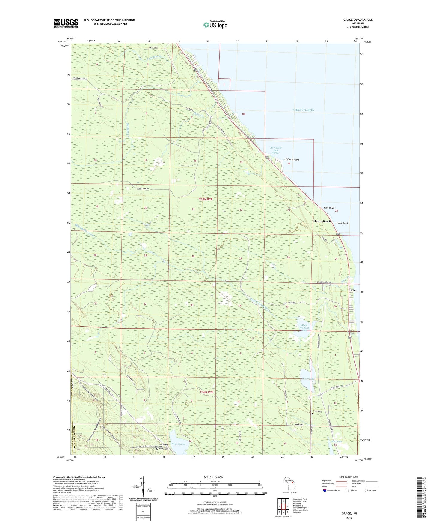
2023 topographic map quadrangle Grace in the state of Michigan. Scale: 1:24000. Based on the newly updated USGS 7.5' US Topo map series, this map is in the following counties: Presque Isle, Cheboygan. The map contains contour data, water features, and other items you are used to seeing on USGS maps, but also has updated roads and other features. This is the next generation of topographic maps. Printed on high-quality waterproof paper with UV fade-resistant inks.
Quads adjacent to this one:
West: Manning
Northwest: Cordwood Point
North: Ninemile Point
East: Grace OE E
Southeast: Ocqueoc
South: Black Lake Bluffs
Southwest: Hangore Heights
This map covers the same area as the classic USGS quad with code o45084e2.
Contains the following named places: Black Lake State Forest Cemetery, Black Mallard Lake, Black Mallard River, Clear Lake, Grace, Grace Cemetery, Grace Creek, Grace Post Office, Hammond Bay Harbor, Highway Point, Huron Beach, Lake Huron Historical Marker, Lake Sixteen, Lone Pine Creek, Mast Point, Mud Lake, Mulligan Creek, State Highway Park Area, Three Creek, Township of Bearinger