MyTopo
Black Lake Bluffs Michigan US Topo Map
Couldn't load pickup availability
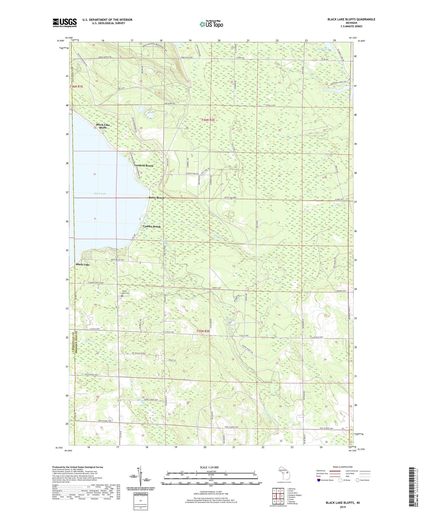
2023 topographic map quadrangle Black Lake Bluffs in the state of Michigan. Scale: 1:24000. Based on the newly updated USGS 7.5' US Topo map series, this map is in the following counties: Presque Isle, Cheboygan. The map contains contour data, water features, and other items you are used to seeing on USGS maps, but also has updated roads and other features. This is the next generation of topographic maps. Printed on high-quality waterproof paper with UV fade-resistant inks.
Quads adjacent to this one:
West: Hangore Heights
Northwest: Manning
North: Grace
Northeast: Grace OE E
East: Ocqueoc
Southeast: Millersburg
South: Onaway
Southwest: Tower
This map covers the same area as the classic USGS quad with code o45084d2.
Contains the following named places: Allis Post Office, Bearinger Union School Historical Marker, Black Lake, Black Lake Bluffs, Canfield Beach, Coddes Beach, Cold Creek, Grace School, Joy Community Church, Michigan Department of Natural Resources Onaway Field Office, North Allis Cemetery, Onaway State Park, Orchard Lake, Rainy Beach, Rainy River, Roberts School, Rowe School, Township of North Allis