MyTopo
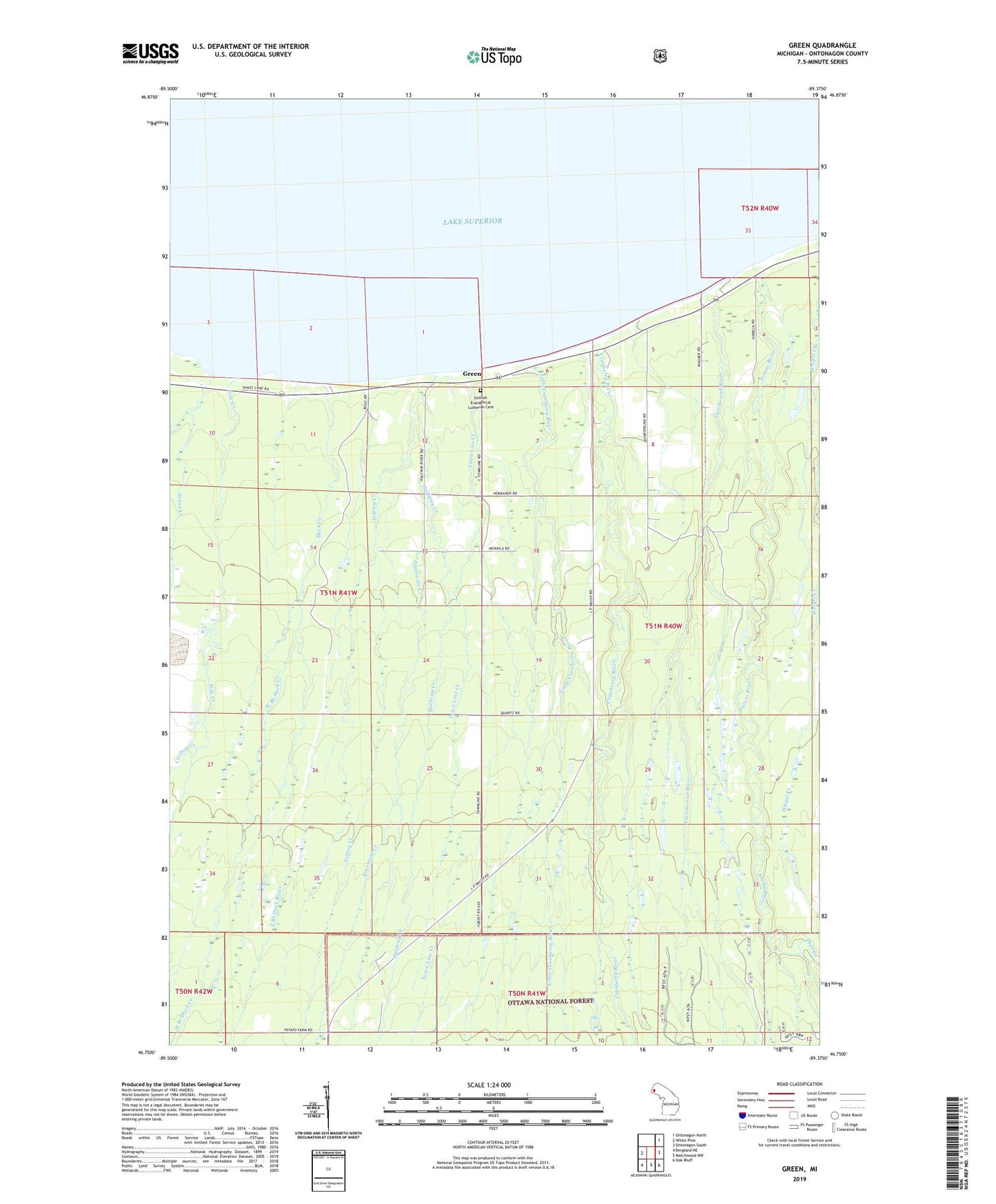
Green Michigan US Topo Map
Couldn't load pickup availability
Also explore the Green Forest Service Topo of this same quad for updated USFS data
2023 topographic map quadrangle Green in the state of Michigan. Scale: 1:24000. Based on the newly updated USGS 7.5' US Topo map series, this map is in the following counties: Ontonagon. The map contains contour data, water features, and other items you are used to seeing on USGS maps, but also has updated roads and other features. This is the next generation of topographic maps. Printed on high-quality waterproof paper with UV fade-resistant inks.
Quads adjacent to this one:
West: White Pine
Northeast: Ontonagon North
East: Ontonagon South
Southeast: Oak Bluff
South: Matchwood NW
Southwest: Bergland NE
This map covers the same area as the classic USGS quad with code o46089g4.
Contains the following named places: Argentine Creek, Caribou Creek, Carp Lake School, Cranberry River, Cunningham Creek, Deer Creek, Diggings Creek, Duck Creek, East Branch Duck River, Finnish Evangelical Lutheran Cemetery, Floodwood River, Green, Green Park Picnic Area, Green Post Office, Halfway Creek, Little Cranberry River, Mendenhall Creek, Miles Creek, Pine Creek, Potato River, Stony Creek, Tolfrey Creek, Town Line Creek, Weigel Creek, West Branch Duck Creek