MyTopo
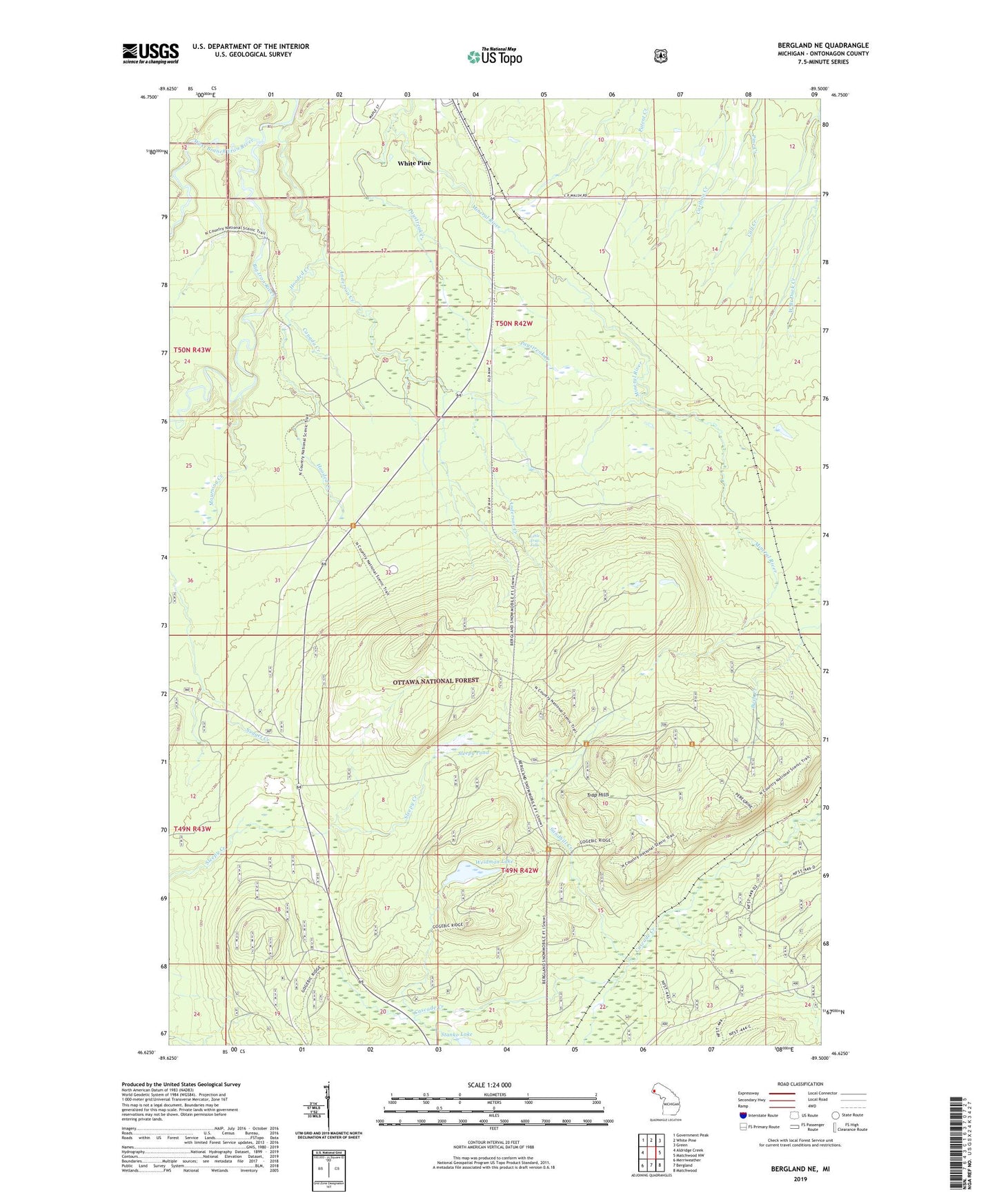
Bergland NE Michigan US Topo Map
Couldn't load pickup availability
Also explore the Bergland NE Forest Service Topo of this same quad for updated USFS data
2023 topographic map quadrangle Bergland NE in the state of Michigan. Scale: 1:24000. Based on the newly updated USGS 7.5' US Topo map series, this map is in the following counties: Ontonagon. The map contains contour data, water features, and other items you are used to seeing on USGS maps, but also has updated roads and other features. This is the next generation of topographic maps. Printed on high-quality waterproof paper with UV fade-resistant inks.
Quads adjacent to this one:
West: Aldridge Creek
Northwest: Government Peak
North: White Pine
Northeast: Green
East: Matchwood NW
Southeast: Matchwood
South: Bergland
Southwest: Merriweather
This map covers the same area as the classic USGS quad with code o46089f5.
Contains the following named places: Anderson Creek, Bergland Lookout Tower, Calf Creek, Canada Creek, Hooded Creek, Krobath Cabin, Little Trap Falls, Loggerhead Creek, Mourning Creek, Paystreak Creek, Sandhill Creek, Sleepy Pond, Stanko Lake, Trap Hills, Weidman Lake, West Branch Iron River, White Pine Census Designated Place, White Pine Mine