MyTopo
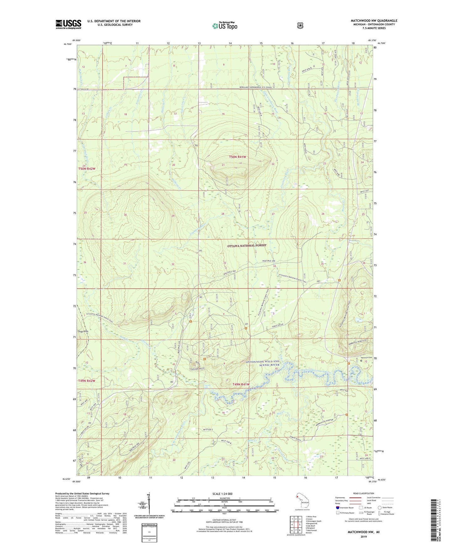
Matchwood NW Michigan US Topo Map
Couldn't load pickup availability
Also explore the Matchwood NW Forest Service Topo of this same quad for updated USFS data
2023 topographic map quadrangle Matchwood NW in the state of Michigan. Scale: 1:24000. Based on the newly updated USGS 7.5' US Topo map series, this map is in the following counties: Ontonagon. The map contains contour data, water features, and other items you are used to seeing on USGS maps, but also has updated roads and other features. This is the next generation of topographic maps. Printed on high-quality waterproof paper with UV fade-resistant inks.
Quads adjacent to this one:
West: Bergland NE
Northwest: White Pine
North: Green
Northeast: Ontonagon South
East: Oak Bluff
Southeast: Ewen
South: Matchwood
Southwest: Bergland
This map covers the same area as the classic USGS quad with code o46089f4.
Contains the following named places: Bebo Creek, Bush Creek, Cascade Creek, Cascade Falls, Clifton Creek, Livingston Creek, Mason Creek, Match Creek, Mill Creek, Norwich Cemetery, Norwich Lookout Tower, Norwich Mine, Woodpecker Creek