MyTopo
White Pine Michigan US Topo Map
Couldn't load pickup availability
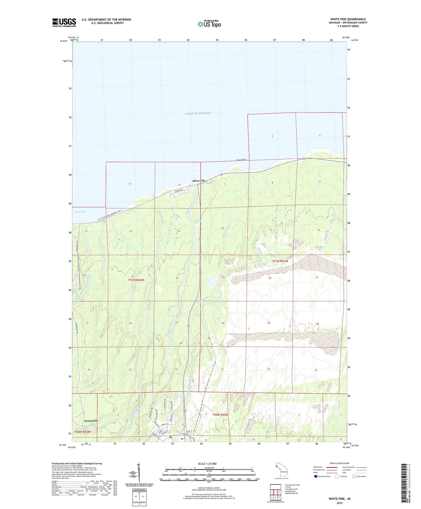
2023 topographic map quadrangle White Pine in the state of Michigan. Scale: 1:24000. Based on the newly updated USGS 7.5' US Topo map series, this map is in the following counties: Ontonagon. The map contains contour data, water features, and other items you are used to seeing on USGS maps, but also has updated roads and other features. This is the next generation of topographic maps. Printed on high-quality waterproof paper with UV fade-resistant inks.
Quads adjacent to this one:
West: Government Peak
East: Green
Southeast: Matchwood NW
South: Bergland NE
Southwest: Aldridge Creek
This map covers the same area as the classic USGS quad with code o46089g5.
Contains the following named places: Ash Creek, Big Iron River, Bonanza Falls, Carp Lake Township Fire Department, Carp Lake Township Library, Faith Lutheran Church, Gull Point, Little Iron River, Little Union Gorge Falls, Little Union River, Mineral River, Mud Creek, Native Creek, Nonesuch, Nonesuch Falls, Nonesuch Post Office, Patent Creek, Pewabeck Falls, Saint Judes Catholic Church, Silver City, Union Bay, Union River, White Pine, White Pine Elementary School, White Pine Mine, White Pine Post Office, White Pine Station, White Pine United Methodist Chuch