MyTopo
Hadley Michigan US Topo Map
Couldn't load pickup availability
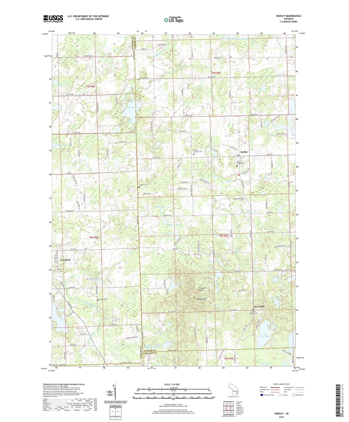
2023 topographic map quadrangle Hadley in the state of Michigan. Scale: 1:24000. Based on the newly updated USGS 7.5' US Topo map series, this map is in the following counties: Lapeer, Genesee, Oakland. The map contains contour data, water features, and other items you are used to seeing on USGS maps, but also has updated roads and other features. This is the next generation of topographic maps. Printed on high-quality waterproof paper with UV fade-resistant inks.
Quads adjacent to this one:
West: Goodrich
Northwest: Davison
North: Elba
Northeast: Lapeer
East: Metamora
Southeast: Oxford
South: Ortonville
Southwest: Davisburg
This map covers the same area as the classic USGS quad with code o42083h4.
Contains the following named places: Algoe Lake, Big Fish Lake, Brigham Lake, Bunnel Lake, Camp Lakeview, Davison Lake, Fox Lake, Green Corners Cemetery, Hadley, Hadley Acres Golf Club, Hadley Baptist Church, Hadley Community Church, Hadley Elementary School, Hadley Hills, Hadley Post Office, Hadley Township Fire Department, Hadley Village Cemetery, Hanover Lake, Hasler Inlet, Hasley Lake, Hemingway Lake, Kerr Hill, Kipp's Corners Post Office, Koester Lakes, Kuhn Lake, Lake Marion, Lapeer District Library-Hadley Branch, Mill Creek, Mitten Lake, Ortonville State Recreation Area, Paddison Drain, Pinnacle Point, Riley Lake, Round Lake, Sanborn Cemetery, Sawmill Lake, Seeley Lake, South Hadley Cemetery, South Hadley Church, Spring Bank Creek, Sweers Cemetery, Tody Lake, Township of Hadley, Webster Lake, WFUM-FM (Flint), WFUM-TV (Flint), ZIP Codes: 48438, 48440