
MyTopo
Hickman Lake Michigan US Topo Map
Couldn't load pickup availability
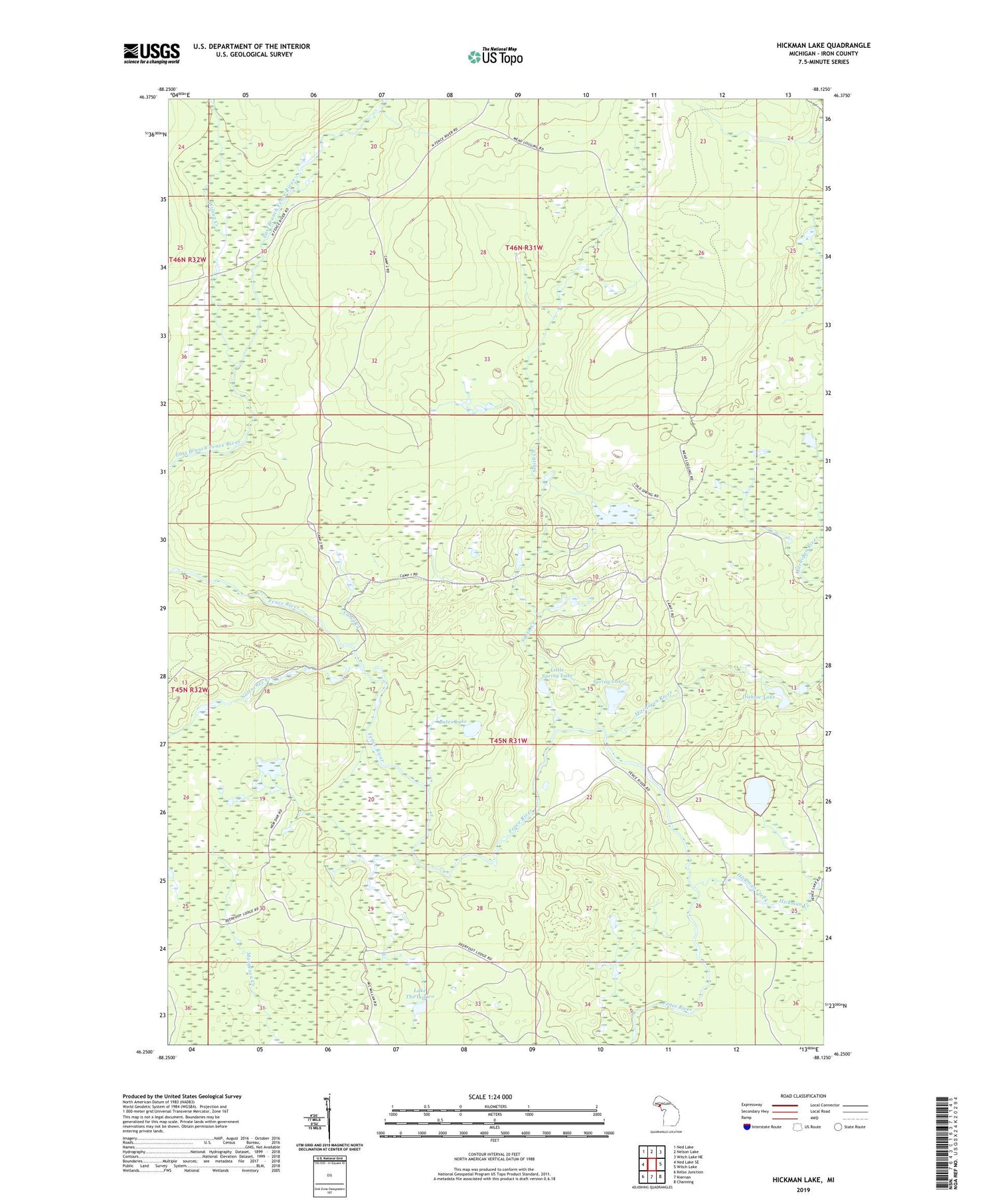
2019 topographic map quadrangle Hickman Lake in the state of Michigan. Scale: 1:24000. Based on the newly updated USGS 7.5' US Topo map series, this map is in the following counties: Iron. The map contains contour data, water features, and other items you are used to seeing on USGS maps, but also has updated roads and other features. This is the next generation of topographic maps. Printed on high-quality waterproof paper with UV fade-resistant inks.
Quads adjacent to this one:
West: Ned Lake SE
Northwest: Ned Lake
North: Nelson Lake
Northeast: Witch Lake NE
East: Witch Lake
Southeast: Channing
South: Kiernan
Southwest: Kelso Junction
Contains the following named places: Bates Lake, Bullhead Lake, Camp Creek, Crane Lake, Dishaw Lake, Dishaws Camp, Hickman Creek, Hickman Lake, Lake Thirty Two, Little Spring Lake, Mitchigan River, Nolenchec Creek, Smith Creek, Spring Lake, Wilson Creek


