MyTopo
Ned Lake SE Michigan US Topo Map
Couldn't load pickup availability
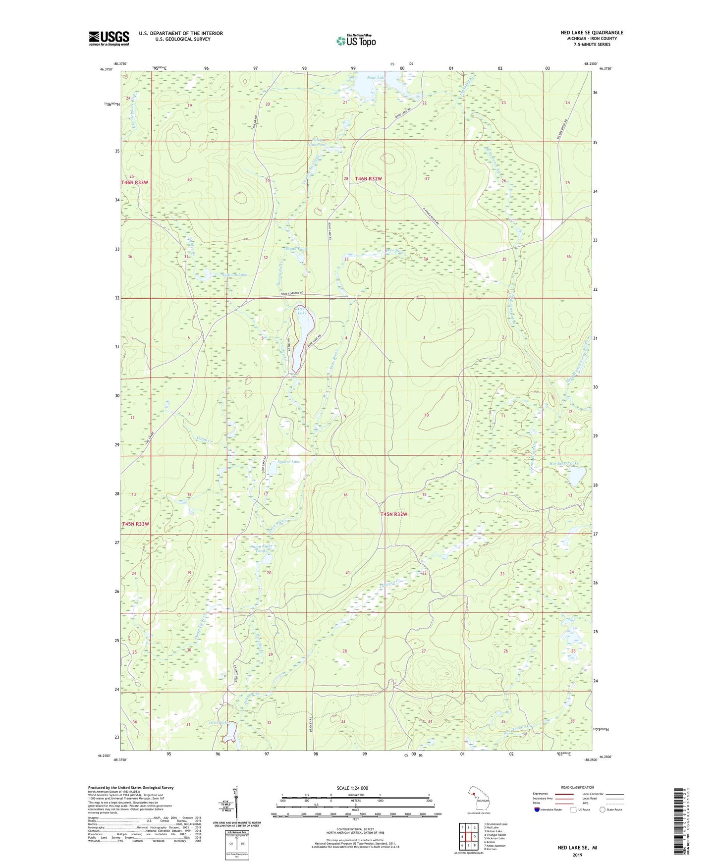
2023 topographic map quadrangle Ned Lake SE in the state of Michigan. Scale: 1:24000. Based on the newly updated USGS 7.5' US Topo map series, this map is in the following counties: Iron. The map contains contour data, water features, and other items you are used to seeing on USGS maps, but also has updated roads and other features. This is the next generation of topographic maps. Printed on high-quality waterproof paper with UV fade-resistant inks.
Quads adjacent to this one:
West: Triangle Ranch
Northwest: Drummond Lake
North: Ned Lake
Northeast: Nelson Lake
East: Hickman Lake
Southeast: Kiernan
South: Kelso Junction
Southwest: Amasa
This map covers the same area as the classic USGS quad with code o46088c3.
Contains the following named places: Bone Lake, Camp Creek, Camp Eight Creek, Camp Eight Ponds, Deer Lake, Deer Lake State Forest Campground, Diana Pond, East Branch Fence River, Flanigan Creek, Forty Nine Pond, Fribley Creek, Hardwood Lake, Johnson Creek, Jones Camp Creek, Otter Lake, Square Lake, Sullivan Lake, Twenty Six Creek, West Branch Fence River