MyTopo
Kelso Junction Michigan US Topo Map
Couldn't load pickup availability
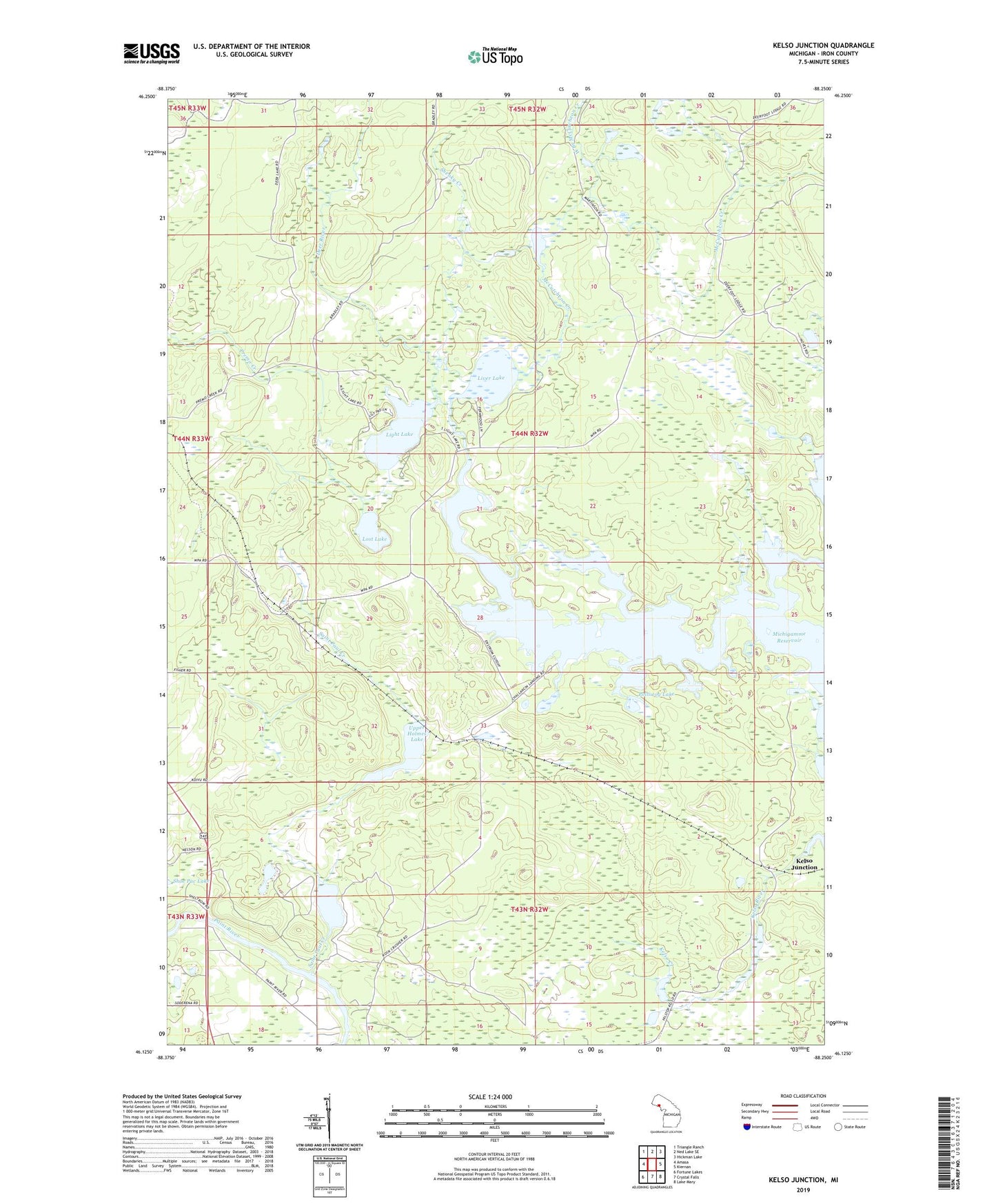
2023 topographic map quadrangle Kelso Junction in the state of Michigan. Scale: 1:24000. Based on the newly updated USGS 7.5' US Topo map series, this map is in the following counties: Iron. The map contains contour data, water features, and other items you are used to seeing on USGS maps, but also has updated roads and other features. This is the next generation of topographic maps. Printed on high-quality waterproof paper with UV fade-resistant inks.
Quads adjacent to this one:
West: Amasa
Northwest: Triangle Ranch
North: Ned Lake SE
Northeast: Hickman Lake
East: Kiernan
Southeast: Lake Mary
South: Crystal Falls
Southwest: Fortune Lakes
This map covers the same area as the classic USGS quad with code o46088b3.
Contains the following named places: Deer River, Gagnon Dam, Kelso Creek, Kelso Junction, Kelso River, Light Lake, Liver Lake, Lost Lake, Lower Holmes Lake, McCutcheon Creek, McCutcheon Lake, Mitchell Spur, Polliwog Lake, Premo Creek, Saint Paul Creek, Shenky Creek, Township of Crystal Falls, Upper Holmes Lake, West Branch McCutcheon Creek, ZIP Code: 49920