MyTopo
Hillman Michigan US Topo Map
Couldn't load pickup availability
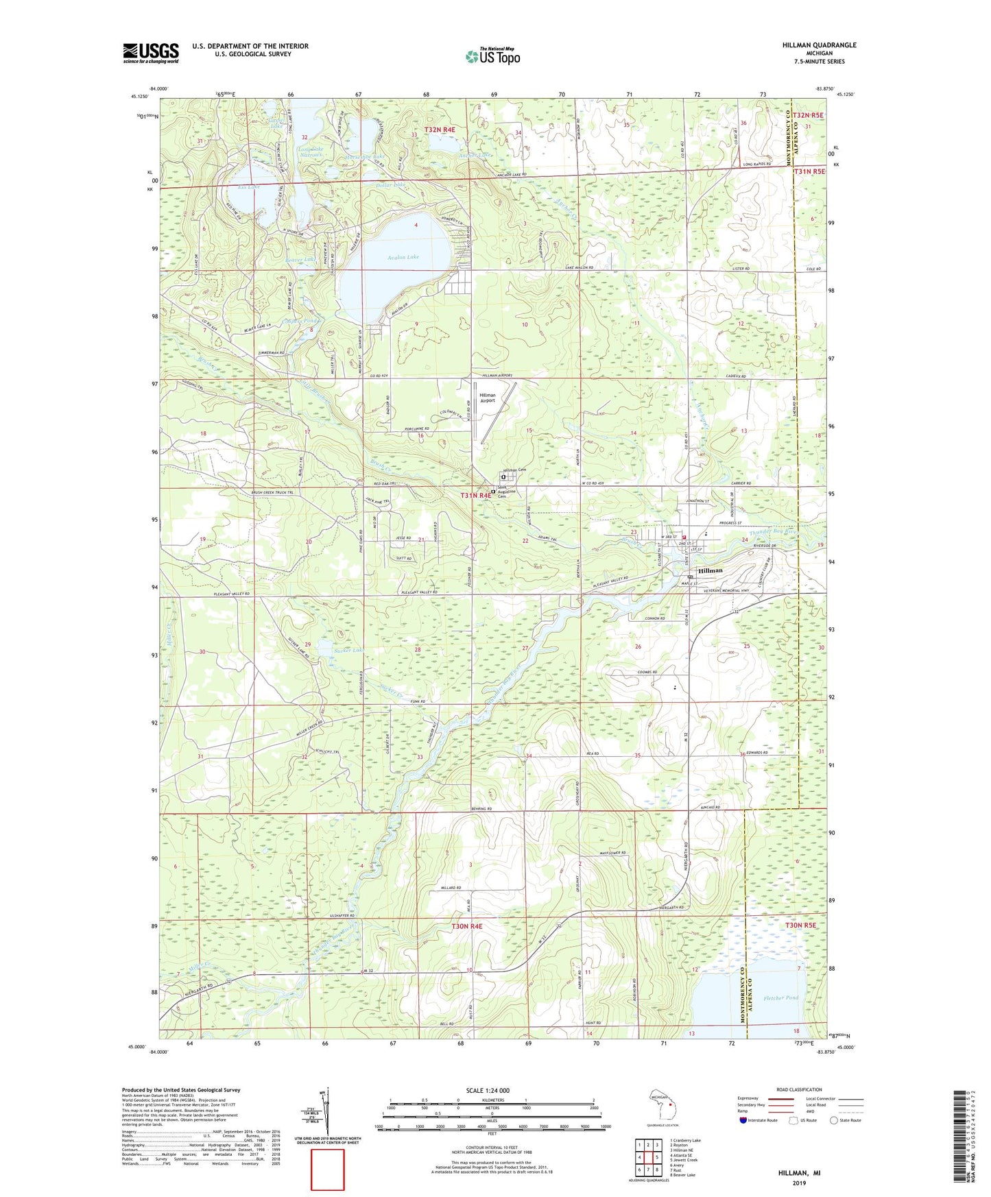
2023 topographic map quadrangle Hillman in the state of Michigan. Scale: 1:24000. Based on the newly updated USGS 7.5' US Topo map series, this map is in the following counties: Montmorency, Alpena. The map contains contour data, water features, and other items you are used to seeing on USGS maps, but also has updated roads and other features. This is the next generation of topographic maps. Printed on high-quality waterproof paper with UV fade-resistant inks.
Quads adjacent to this one:
West: Atlanta SE
Northwest: Cranberry Lake
North: Royston
Northeast: Hillman NE
East: Jewett Creek
Southeast: Beaver Lake
South: Rust
Southwest: Avery
This map covers the same area as the classic USGS quad with code o45083a8.
Contains the following named places: Anchor Creek, Anchor Lake, Avalon Lake, Beaver Lake, Brush Creek, Calvary Church Historical Marker, Calvary Episcopal Church, Coopers Pond, Dollar Lake, Ess Lake, Ess Lake State Forest Campground, Gassel Lake, Hillman, Hillman Airport, Hillman Cemetery, Hillman Elementary School, Hillman Fire Department, Hillman Free Methodist Church, Hillman Junior Senior High School, Hillman Post Office, Hillman Station, Hillman United Methodist Church, Hillman Wright Library, Horseshoe Lake, Little Brush Creek, Long Lake Narrows, Miller Creek, Montmorency Township Hall, Niergarth School, Saint Augustine Cemetery, Saint Augustine Church, South Bay Campground, Sucker Creek, Sucker Lake, Thunder Bay Golf Resort, Village of Hillman, ZIP Code: 49746