MyTopo
Rust Michigan US Topo Map
Couldn't load pickup availability
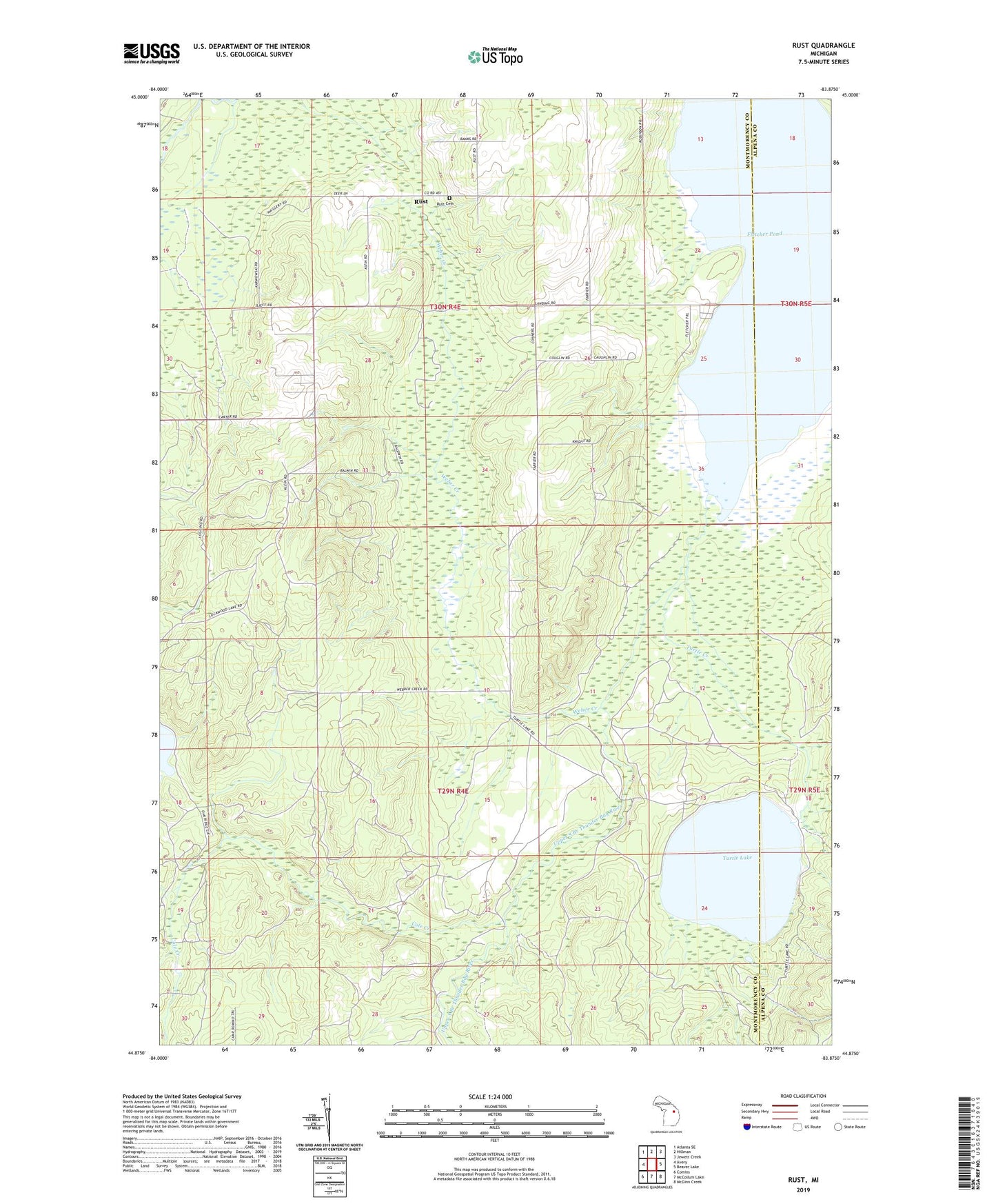
2023 topographic map quadrangle Rust in the state of Michigan. Scale: 1:24000. Based on the newly updated USGS 7.5' US Topo map series, this map is in the following counties: Montmorency, Alpena. The map contains contour data, water features, and other items you are used to seeing on USGS maps, but also has updated roads and other features. This is the next generation of topographic maps. Printed on high-quality waterproof paper with UV fade-resistant inks.
Quads adjacent to this one:
West: Avery
Northwest: Atlanta SE
North: Hillman
Northeast: Jewett Creek
East: Beaver Lake
Southeast: McGinn Creek
South: McCollum Lake
Southwest: Comins
This map covers the same area as the classic USGS quad with code o44083h8.
Contains the following named places: Cole Creek, Maple Grove Brethren in Christ Church, Rust, Rust Cemetery, Rust Post Office, Rust School, Township of Rust, Turtle Creek, Turtle Lake, Turtle Lake Club Airport, Upper South Branch Thunder Bay River, Weber Creek