MyTopo
Cranberry Lake Michigan US Topo Map
Couldn't load pickup availability
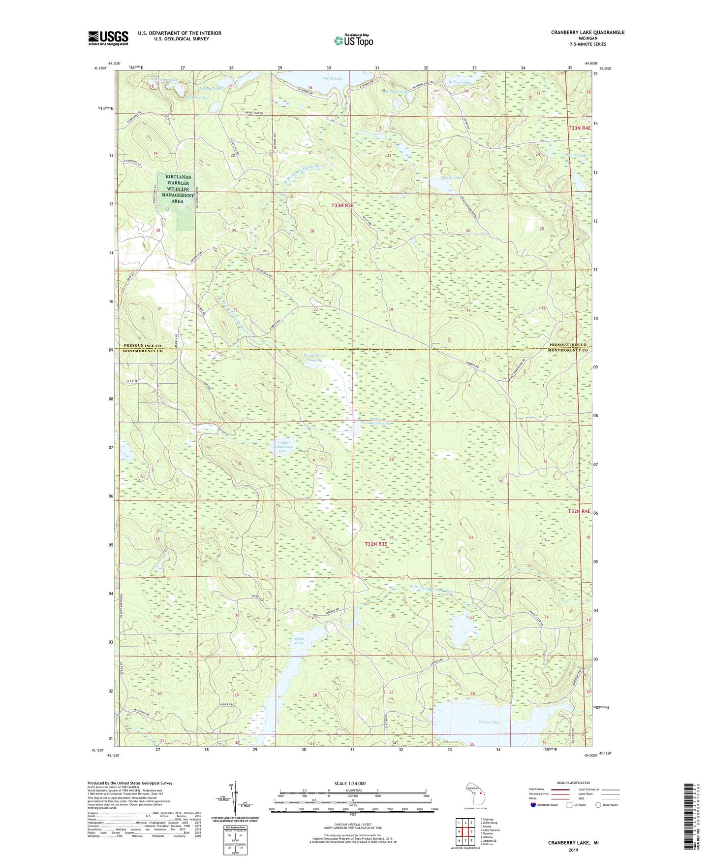
2023 topographic map quadrangle Cranberry Lake in the state of Michigan. Scale: 1:24000. Based on the newly updated USGS 7.5' US Topo map series, this map is in the following counties: Montmorency, Presque Isle. The map contains contour data, water features, and other items you are used to seeing on USGS maps, but also has updated roads and other features. This is the next generation of topographic maps. Printed on high-quality waterproof paper with UV fade-resistant inks.
Quads adjacent to this one:
West: Lake Geneva
Northwest: Onaway
North: Millersburg
Northeast: Hawks
East: Royston
Southeast: Hillman
South: Atlanta SE
Southwest: Atlanta
This map covers the same area as the classic USGS quad with code o45084b1.
Contains the following named places: Comstock Lake, Cranberry Lake, Grass Lake, Hagensville Hunting Club, Healy Lake, Hessler Lake, Kelsey Lake, Krauth Lake, Lower Tomahawk Lake, McAvoy Lake, Moores Lake, Rainbow Lake, Rainy Lake, Rainy River Dam, Rainy River Flooding, Township of Montmorency, Upper Tomahawk Lake, West Branch Upper Rainy River