MyTopo
Walton Michigan US Topo Map
Couldn't load pickup availability
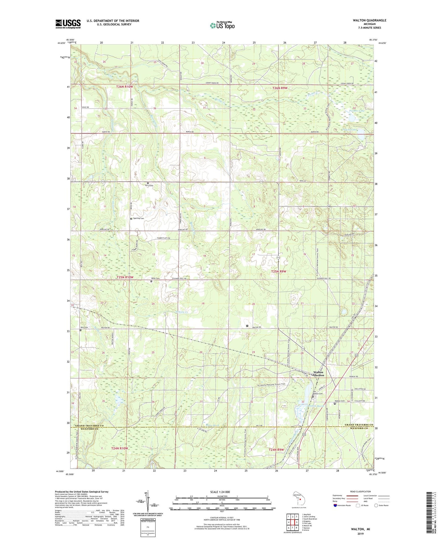
2023 topographic map quadrangle Walton in the state of Michigan. Scale: 1:24000. Based on the newly updated USGS 7.5' US Topo map series, this map is in the following counties: Grand Traverse, Wexford. The map contains contour data, water features, and other items you are used to seeing on USGS maps, but also has updated roads and other features. This is the next generation of topographic maps. Printed on high-quality waterproof paper with UV fade-resistant inks.
Quads adjacent to this one:
West: Kingsley
Northwest: Mayfield
North: Jacks Landing
Northeast: South Boardman
East: Fife Lake
Southeast: Arlene
South: Manton
Southwest: Mesick NE
This map covers the same area as the classic USGS quad with code o44085e4.
Contains the following named places: Bancroft Creek, Camp Pugsley Correction Facility, Dell Cemetery, Downs Lake, Fife Lake Lookout Tower, Hodge Post Office, Iilif Grave, Jackson Creek, McManus Corner, Milks Cemetery, North Paradise School, Old Walton Cemetery, Parker Creek, Parsons Lake, Pugsley Correctional Facility, Riplow Marsh, Sands Creek, Sparling Cemetery, Township of Fife Lake, Walton, Walton Cemetery, Walton Junction, Walton Marsh, Walton Post Office, Walton Station, Whipple Post Office