MyTopo
Temple Michigan US Topo Map
Couldn't load pickup availability
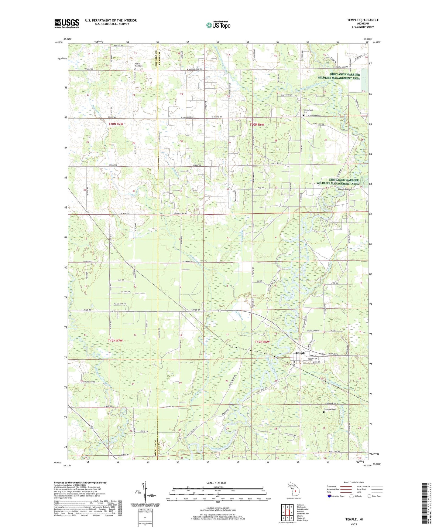
2023 topographic map quadrangle Temple in the state of Michigan. Scale: 1:24000. Based on the newly updated USGS 7.5' US Topo map series, this map is in the following counties: Clare, Osceola. The map contains contour data, water features, and other items you are used to seeing on USGS maps, but also has updated roads and other features. This is the next generation of topographic maps. Printed on high-quality waterproof paper with UV fade-resistant inks.
Quads adjacent to this one:
West: Marion
Northwest: McBain
North: Falmouth
Northeast: Moddersville
East: Prestle Creek
Southeast: Lake George
South: Lake NE
Southwest: Sears
This map covers the same area as the classic USGS quad with code o44085a1.
Contains the following named places: Church Bridge, Clam River, Dishwash Creek, Fernwood Cemetery, Freeman-Redding Oil Field, Giss-I-Was Creek, Grandon Post Office, Grandon School, Green Creek, Halford Creek, Little Norway Creek, Marion Full Gospel Church, Pennock Post Office, Pennock Station, Temple, Temple Forest Campground, Temple Post Office, Temple Station, Township of Redding, Township of Winterfield, Watson Road Cemetery, West Branch Clam River, West Branch Middle Branch River, Whisky Creek, Winterfield Cemetery, Winterfield Oil and Gas Storage Field, Winterfield Post Office, ZIP Code: 49665