MyTopo
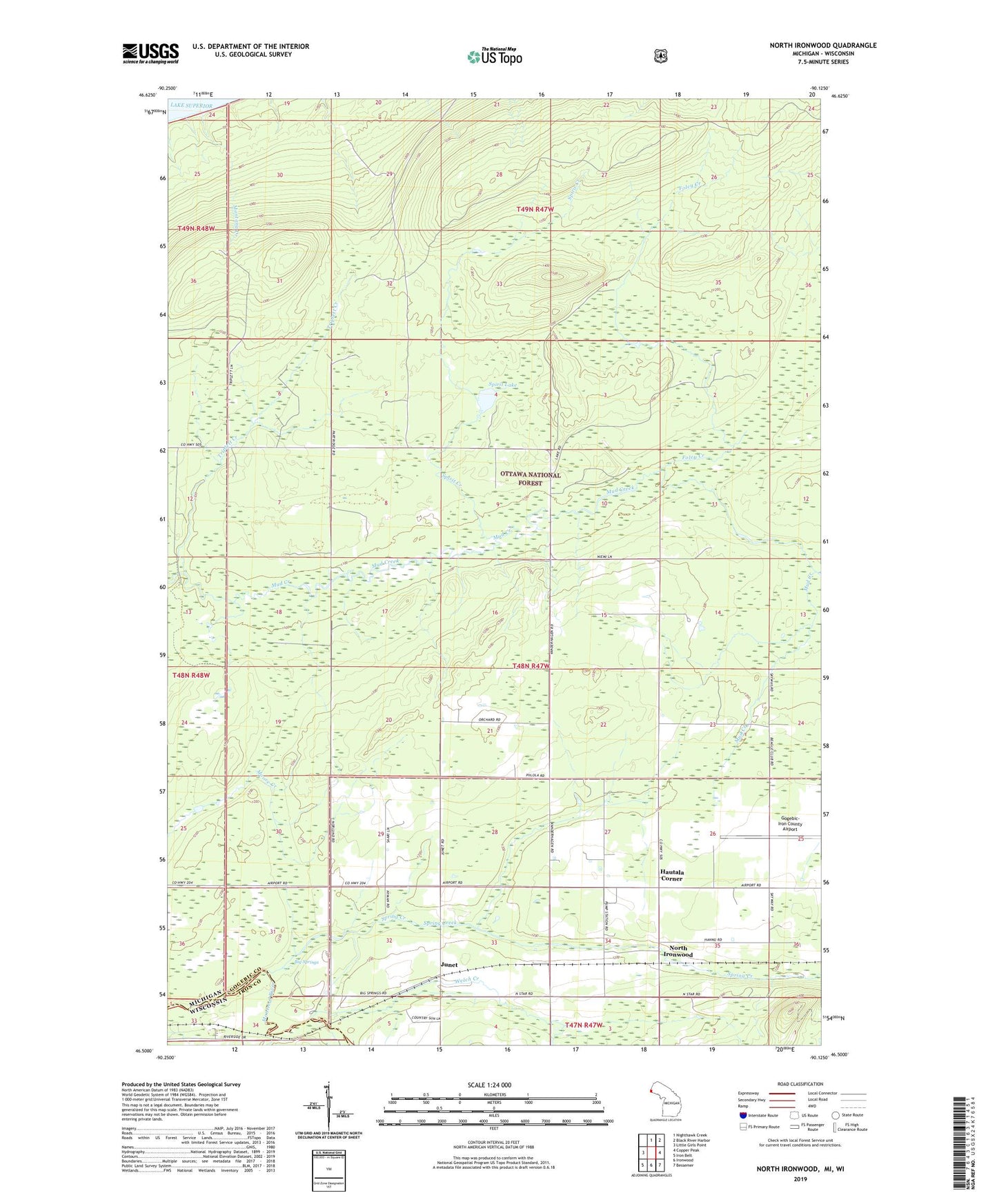
North Ironwood Michigan US Topo Map
Couldn't load pickup availability
Also explore the North Ironwood Forest Service Topo of this same quad for updated USFS data
2023 topographic map quadrangle North Ironwood in the states of Michigan, Wisconsin. Scale: 1:24000. Based on the newly updated USGS 7.5' US Topo map series, this map is in the following counties: Gogebic, Iron. The map contains contour data, water features, and other items you are used to seeing on USGS maps, but also has updated roads and other features. This is the next generation of topographic maps. Printed on high-quality waterproof paper with UV fade-resistant inks.
Quads adjacent to this one:
West: Little Girls Point
North: Nighthawk Creek
Northeast: Black River Harbor
East: Copper Peak
Southeast: Bessemer
South: Ironwood
Southwest: Iron Belt
Contains the following named places: Big Springs, Charter Township of Ironwood, Defer School, Foley Creek, Gogebic-Iron County Airport, Hautala Corner, Junet, Junet Station, Kaari Creek, Montana Creek, Montreal Post Office, Montreal Station, North Ironwood, Roosevelt School, Spirit Creek, Spirit Lake, Spring Creek, Triplett Creek, Welch Creek, ZIP Code: 49938