MyTopo
McBain Michigan US Topo Map
Couldn't load pickup availability
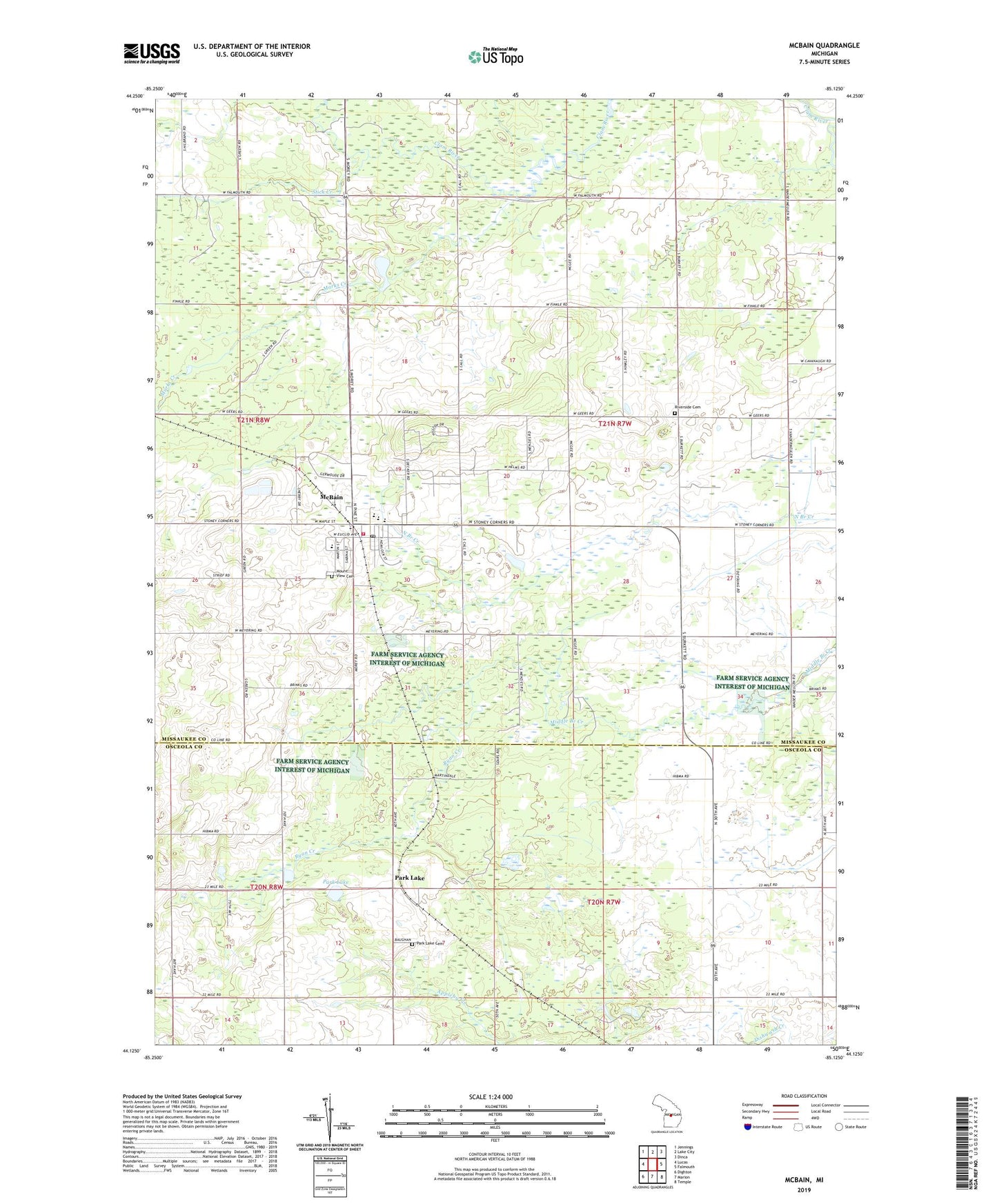
2023 topographic map quadrangle McBain in the state of Michigan. Scale: 1:24000. Based on the newly updated USGS 7.5' US Topo map series, this map is in the following counties: Missaukee, Osceola. The map contains contour data, water features, and other items you are used to seeing on USGS maps, but also has updated roads and other features. This is the next generation of topographic maps. Printed on high-quality waterproof paper with UV fade-resistant inks.
Quads adjacent to this one:
West: Lucas
Northwest: Jennings
North: Lake City
Northeast: Dinca
East: Falmouth
Southeast: Temple
South: Marion
Southwest: Dighton
This map covers the same area as the classic USGS quad with code o44085b2.
Contains the following named places: Calvin Church, City of McBain, Fairdale Park, Great Lakes Family Care Clinic, Marks Creek, McBain, McBain Baptist Church, McBain Christian Reformed Church, McBain Community Fire Department, McBain Community Library, McBain High School, McBain Post Office, McBain Presbyterian Church, McBain Station, Missaukee County Emergency Medical Services McBain, Mount View Cemetery, North Michigan Christian School, Park Lake, Park Lake Cemetery, Park Lake Station, Parklake Post Office, Pine Court Mobile Home Park, Riverside Cemetery, Riverside Gas Field, Ryan Creek, Stick Creek, Township of Riverside, ZIP Code: 49657