MyTopo
Marenisco Michigan US Topo Map
Couldn't load pickup availability
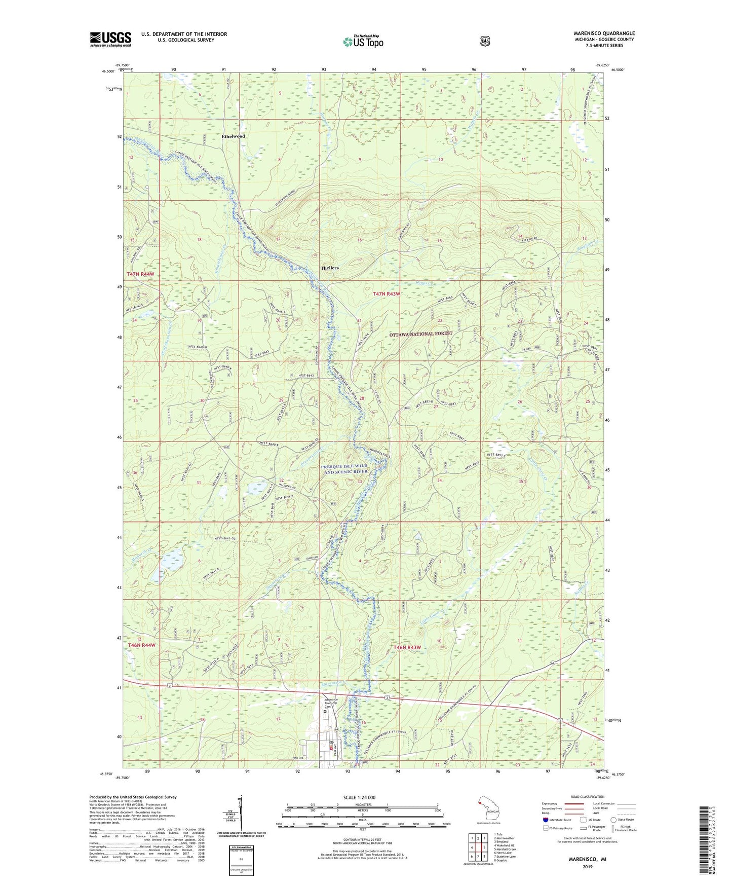
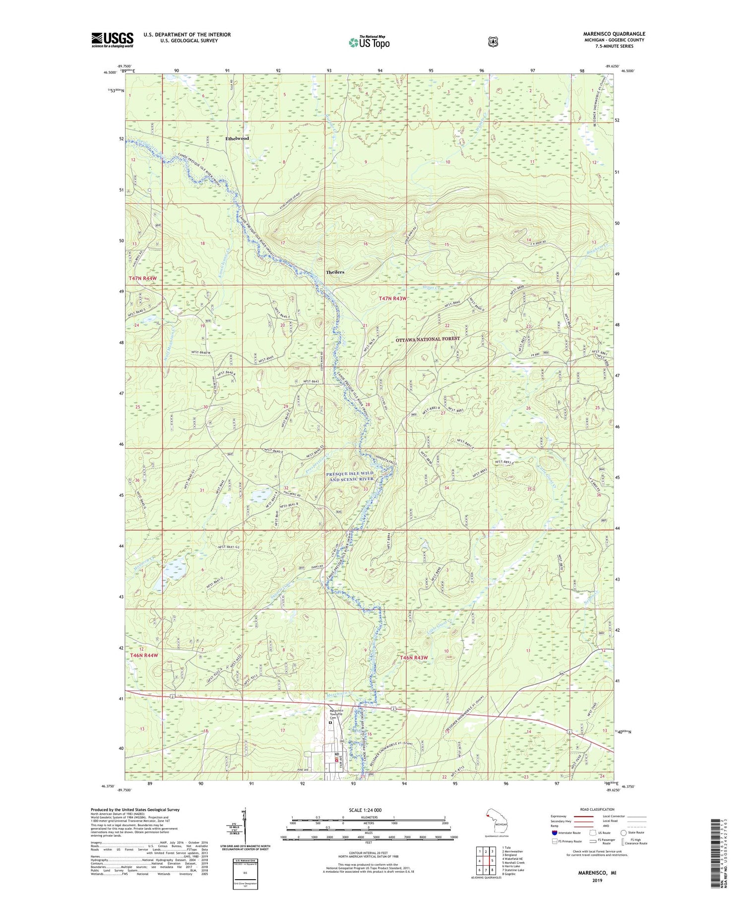
2019 topographic map quadrangle Marenisco in the state of Michigan. Scale: 1:24000. Based on the newly updated USGS 7.5' US Topo map series, this map is in the following counties: Gogebic. The map contains contour data, water features, and other items you are used to seeing on USGS maps, but also has updated roads and other features. This is the next generation of topographic maps. Printed on high-quality waterproof paper with UV fade-resistant inks.
Quads adjacent to this one:
West: Wakefield NE
Northwest: Tula
North: Merriweather
Northeast: Bergland
East: Marshall Creek
Southeast: Gogebic
South: Stateline Lake
Southwest: Harris Lake
Contains the following named places: Copps Creek, Copps Lookout Tower, Ethelwood, Kinnickinnic Creek, Little Giant Creek, Marenisco, Marenisco Ambulance Service, Marenisco Creek, Marenisco Landing Field, Marenisco Lookout Tower, Marenisco Post Office, Marenisco Station, Marenisco Township Cemetery, Marenisco Township Police Department, Marenisco Volunteer Fire Department, Presque Isle Wild and Scenic River, Prospectors Creek, Saint Catherine Catholic Church, Squatters Creek, Theilers, Yondota Falls