MyTopo
Bergland Michigan US Topo Map
Couldn't load pickup availability
Also explore the Bergland Forest Service Topo of this same quad for updated USFS data
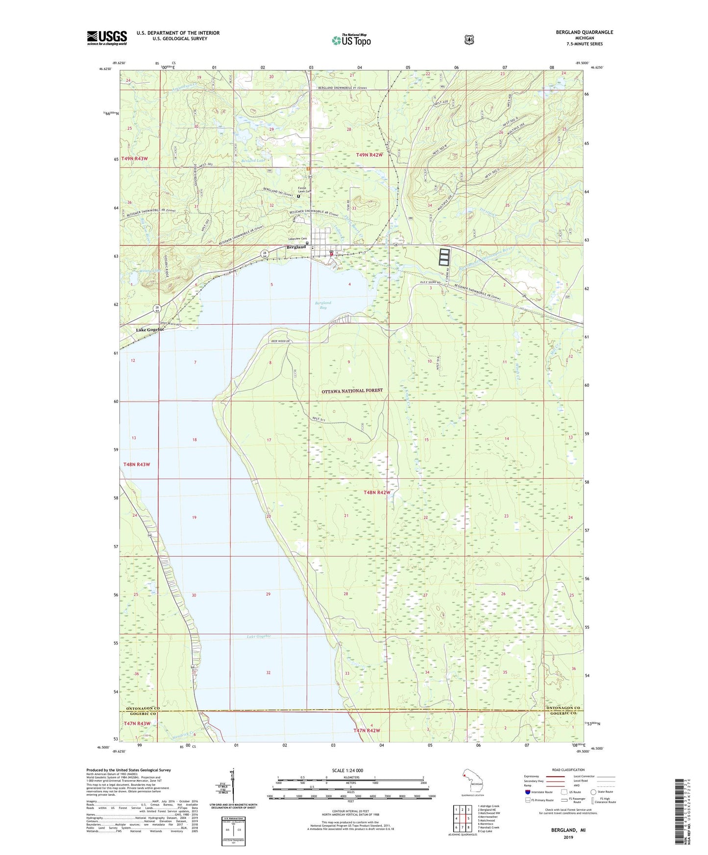
2023 topographic map quadrangle Bergland in the state of Michigan. Scale: 1:24000. Based on the newly updated USGS 7.5' US Topo map series, this map is in the following counties: Ontonagon, Gogebic. The map contains contour data, water features, and other items you are used to seeing on USGS maps, but also has updated roads and other features. This is the next generation of topographic maps. Printed on high-quality waterproof paper with UV fade-resistant inks.
Quads adjacent to this one:
West: Merriweather
Northwest: Aldridge Creek
North: Bergland NE
Northeast: Matchwood NW
East: Matchwood
Southeast: Cup Lake
South: Marshall Creek
Southwest: Marenisco
This map covers the same area as the classic USGS quad with code o46089e5.
Contains the following named places: Bergland, Bergland Bay, Bergland Census Designated Place, Bergland Cross-Country Ski Trail, Bergland Post Office, Bergland Station, Bergland Township Fire Department, Bergland Township Park Picnic Area, Berland Lake, Calvary Baptist Church, Forest Lawn Cemetery, Gogebic - Ontonagon ISD Special Education, Hendrick Creek, Knute Creek, Lake Gogebic, Lake Gogebic Census Designated Place, Lake Gogebic Post Office, Lake Gogebic Station, Lakeview Cemetery, Ontonagon County Park, Ontonagon County Park Campground and Picnic Area, Stindt Creek, Three Bears Creek, Town Line Creek, Trestle Creek, Trinity Lutheran Church, Weary Lake, ZIP Code: 49910