MyTopo
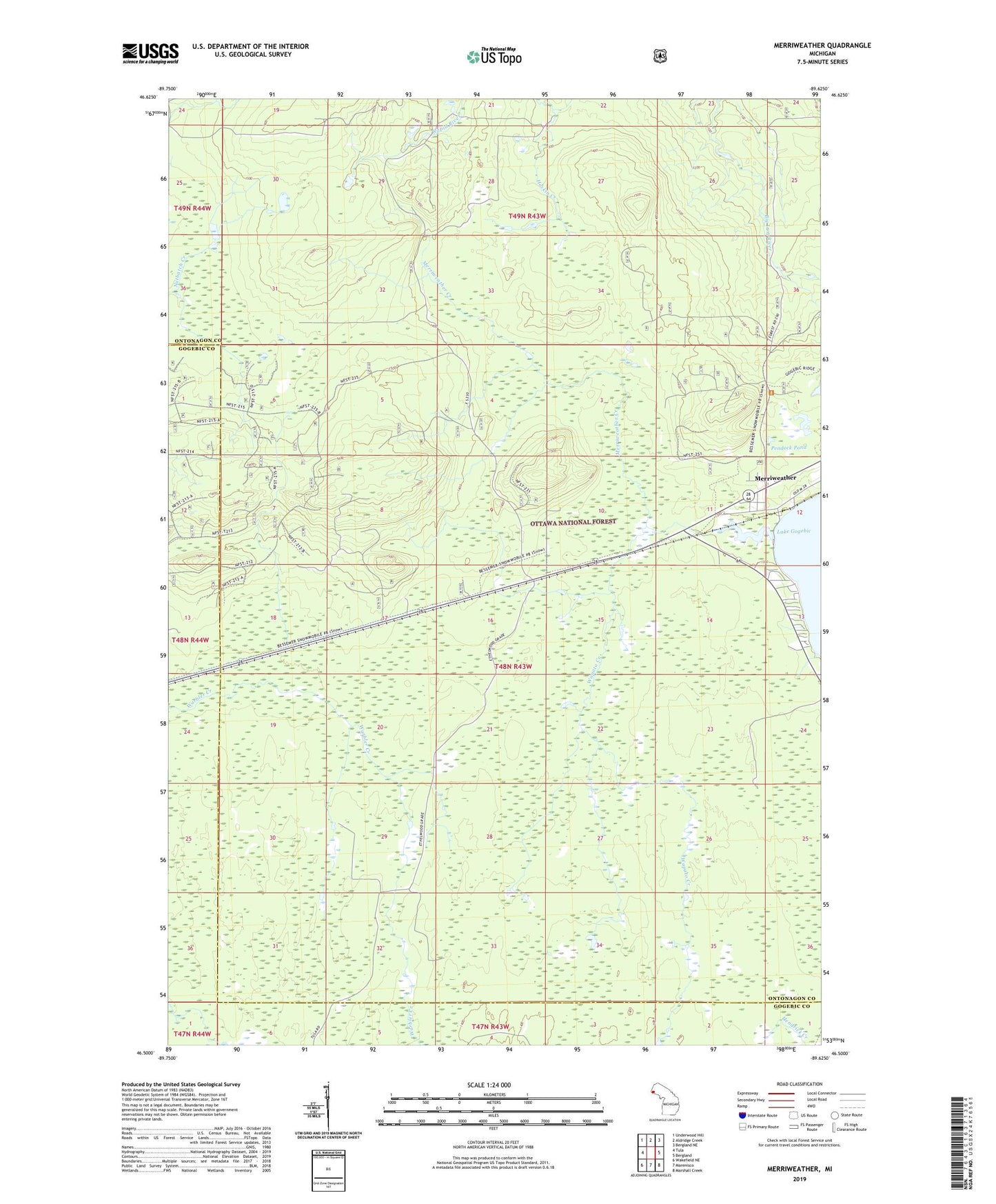
Merriweather Michigan US Topo Map
Couldn't load pickup availability
Also explore the Merriweather Forest Service Topo of this same quad for updated USFS data
2023 topographic map quadrangle Merriweather in the state of Michigan. Scale: 1:24000. Based on the newly updated USGS 7.5' US Topo map series, this map is in the following counties: Ontonagon, Gogebic. The map contains contour data, water features, and other items you are used to seeing on USGS maps, but also has updated roads and other features. This is the next generation of topographic maps. Printed on high-quality waterproof paper with UV fade-resistant inks.
Quads adjacent to this one:
West: Tula
Northwest: Underwood Hill
North: Aldridge Creek
Northeast: Bergland NE
East: Bergland
Southeast: Marshall Creek
South: Marenisco
Southwest: Wakefield NE
This map covers the same area as the classic USGS quad with code o46089e6.
Contains the following named places: Haskin Creek, Merriweather, Merriweather Creek, Merriweather Post Office, Pendock Pond, Township of Bergland, Wapato Creek