MyTopo
Matchwood Michigan US Topo Map
Couldn't load pickup availability
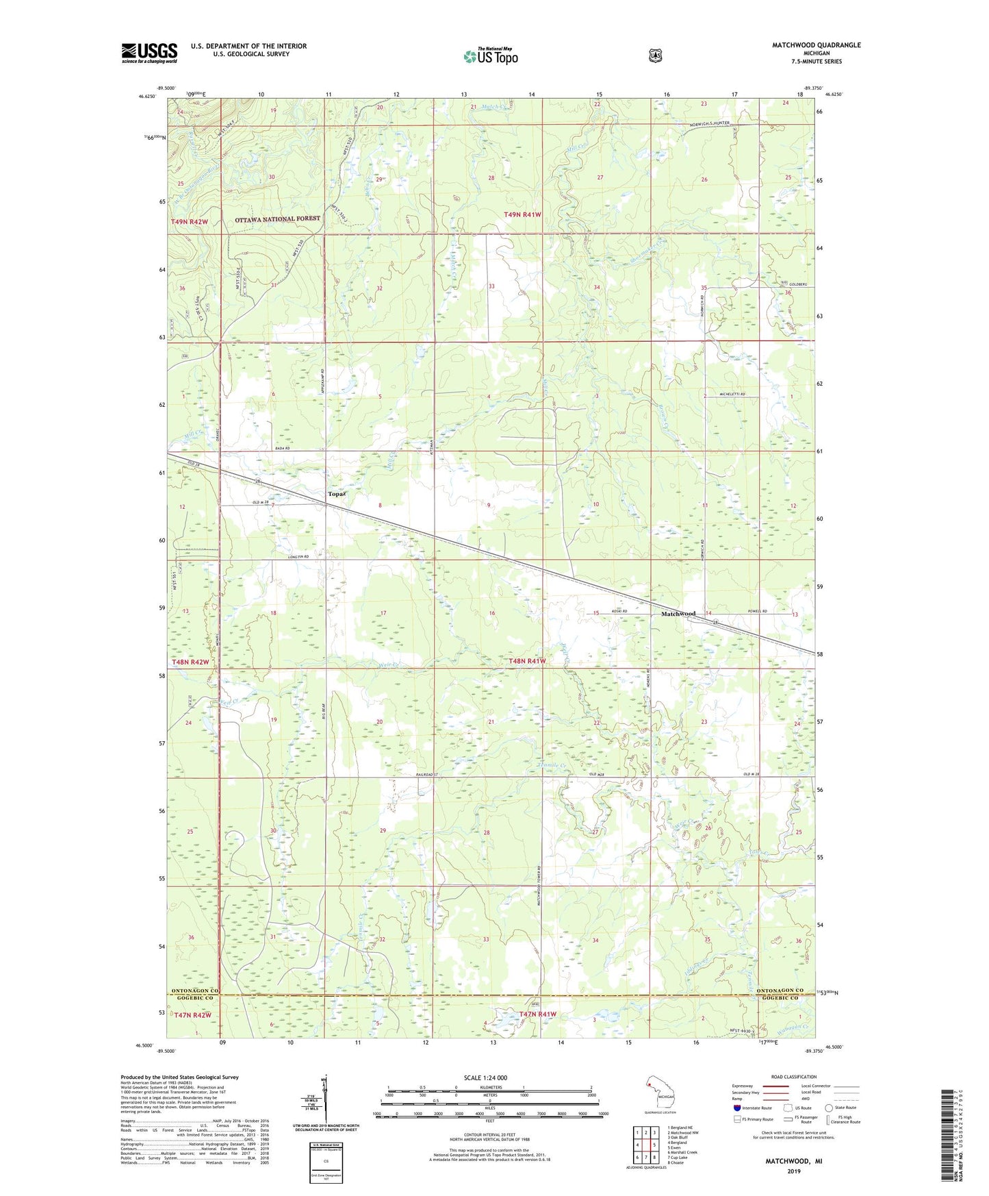
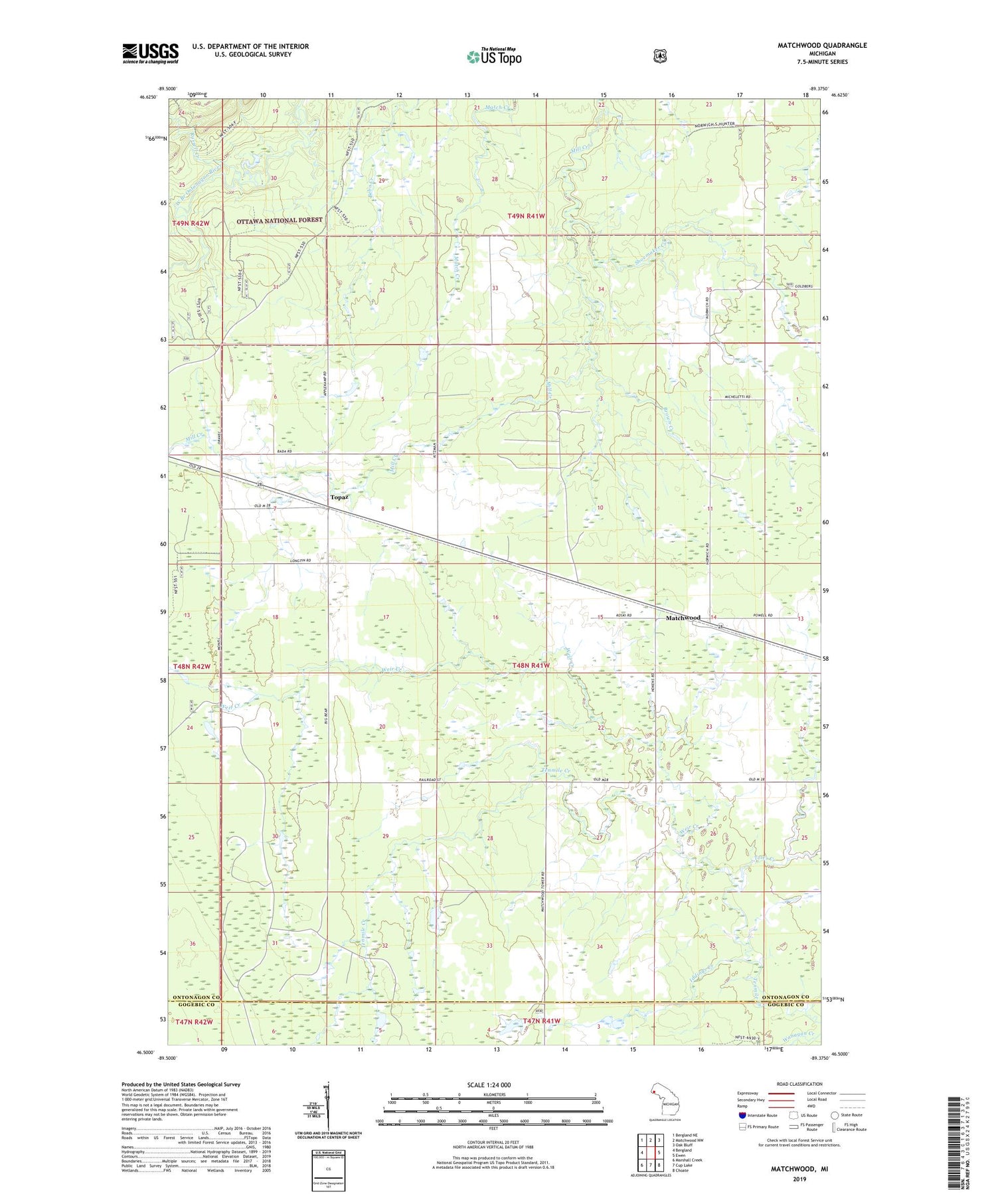
2019 topographic map quadrangle Matchwood in the state of Michigan. Scale: 1:24000. Based on the newly updated USGS 7.5' US Topo map series, this map is in the following counties: Ontonagon, Gogebic. The map contains contour data, water features, and other items you are used to seeing on USGS maps, but also has updated roads and other features. This is the next generation of topographic maps. Printed on high-quality waterproof paper with UV fade-resistant inks.
Quads adjacent to this one:
West: Bergland
Northwest: Bergland NE
North: Matchwood NW
Northeast: Oak Bluff
East: Ewen
Southeast: Choate
South: Cup Lake
Southwest: Marshall Creek
Contains the following named places: Brown Creek, Iddings Creek, Matchwood, Matchwood Post Office, Matchwood Station, Russell Creek, Shoemaker Creek, Toles Creek, Topaz, Topaz Post Office, Topaz Station, Township of Matchwood, Weir Creek