MyTopo
McGinn Creek Michigan US Topo Map
Couldn't load pickup availability
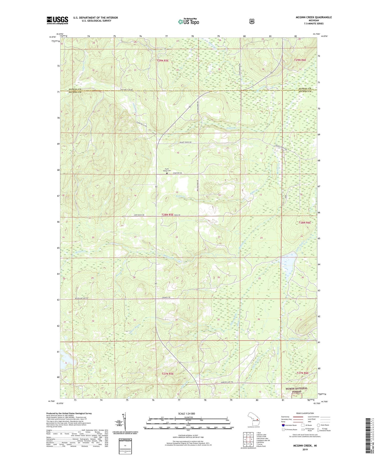
2019 topographic map quadrangle McGinn Creek in the state of Michigan. Scale: 1:24000. Based on the newly updated USGS 7.5' US Topo map series, this map is in the following counties: Alcona, Alpena. The map contains contour data, water features, and other items you are used to seeing on USGS maps, but also has updated roads and other features. This is the next generation of topographic maps. Printed on high-quality waterproof paper with UV fade-resistant inks.
Quads adjacent to this one:
West: McCollum Lake
Northwest: Rust
North: Beaver Lake
Northeast: Evans Creek
East: Hubbard Lake SW
Southeast: Bucks Pond
South: Curran
Southwest: McKinley
Contains the following named places: Bear Creek, Beaver Creek, Bruster Creek, Cranberry Lake, Flynn Valley Cemetery, Hale High School, Indian Creek, Little Wolf Creek, McGinn Creek, McGinn Post Office, Mohr Creek, Ponca Post Office, Robbs Creek, Silver Brook, Silver Creek, Wildcat Creek