MyTopo
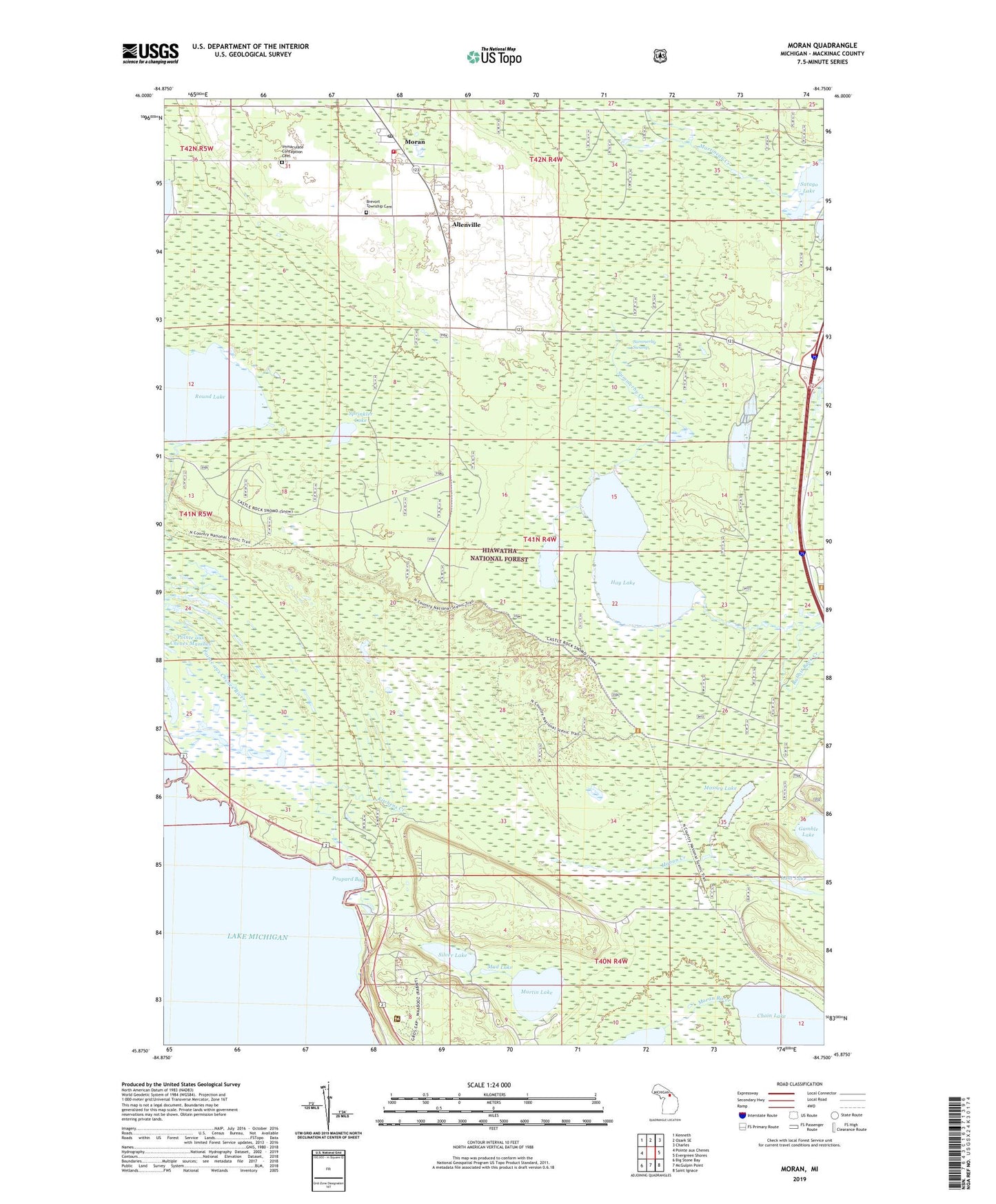
Moran Michigan US Topo Map
Couldn't load pickup availability
Also explore the Moran Forest Service Topo of this same quad for updated USFS data
2023 topographic map quadrangle Moran in the state of Michigan. Scale: 1:24000. Based on the newly updated USGS 7.5' US Topo map series, this map is in the following counties: Mackinac. The map contains contour data, water features, and other items you are used to seeing on USGS maps, but also has updated roads and other features. This is the next generation of topographic maps. Printed on high-quality waterproof paper with UV fade-resistant inks.
Quads adjacent to this one:
West: Pointe aux Chenes
Northwest: Kenneth
North: Ozark SE
Northeast: Charles
East: Evergreen Shores
Southeast: Saint Ignace
South: McGulpin Point
Southwest: Big Stone Bay
This map covers the same area as the classic USGS quad with code o45084h7.
Contains the following named places: Allenville, Allenville Post Office, Allenville Station, Brevort Township Cemetery, Brevort Township Community Recreation Area, Brevort Township Fairground, Brevort Township Fire Department, Chain Lake, Cranberry Lake, Foley Creek Campground, Gamble Lake, Gros Cap Roadside Park, Hay Lake, Immaculate Conception Cemetery, Kitchens Creek, Lant Lake, Martin Lake, Massey Lake, Moran, Moran Post Office, Moran Station, Moran Work Station, Mud Lake, Pointe aux Chenes Marshes, Poupard Bay, Round Lake, Satago Lake, Silver Lake, Silver Mountain Downhill Ski/Tubing Hill, Sprinkler Lake, Summerby Creek, Summerby Swamp, Trinity Lutheran Church, United States Forest Service Saint Ignace Ranger District, Zion Church, ZIP Code: 49781