MyTopo
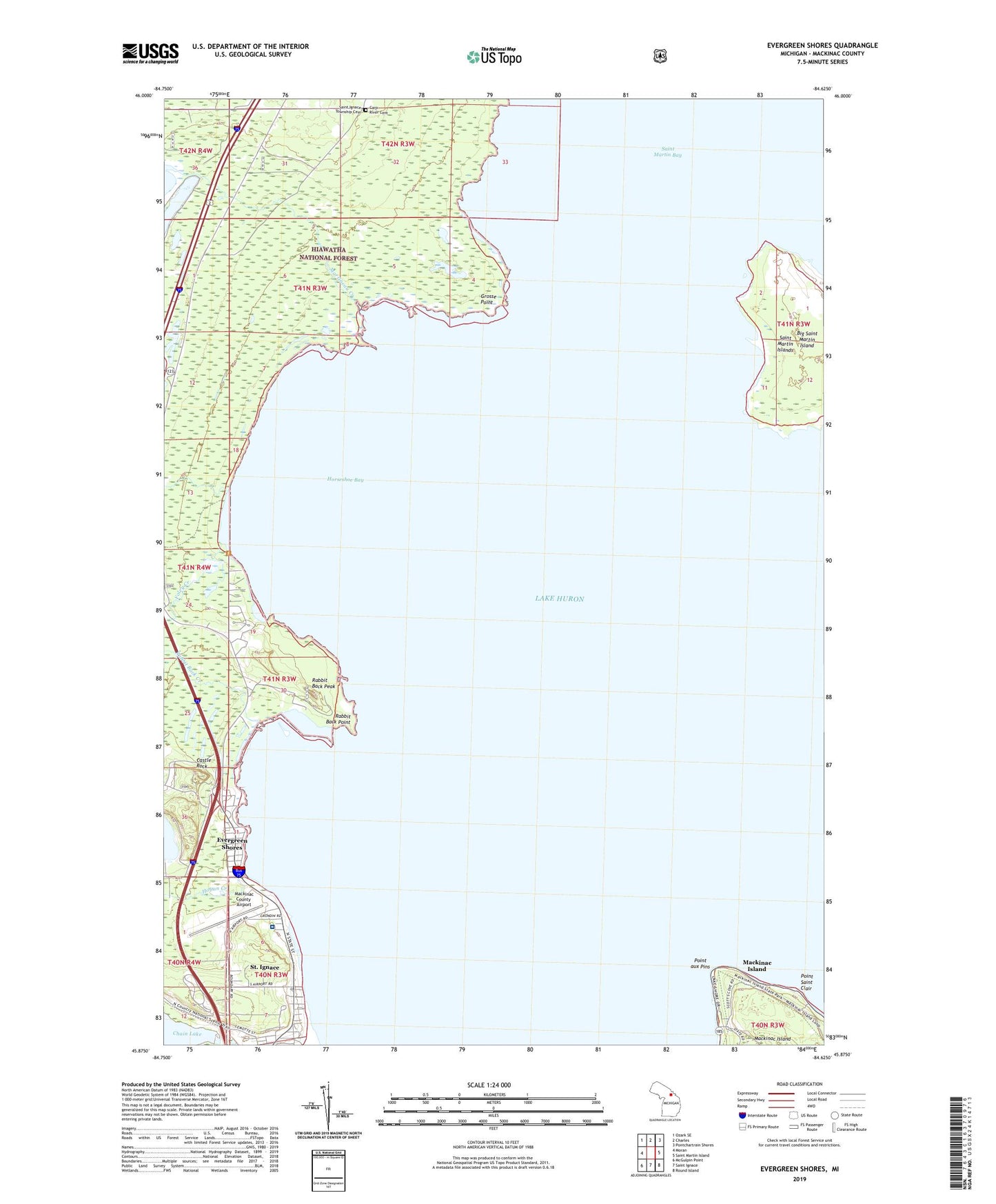
Evergreen Shores Michigan US Topo Map
Couldn't load pickup availability
Also explore the Evergreen Shores Forest Service Topo of this same quad for updated USFS data
2023 topographic map quadrangle Evergreen Shores in the state of Michigan. Scale: 1:24000. Based on the newly updated USGS 7.5' US Topo map series, this map is in the following counties: Mackinac. The map contains contour data, water features, and other items you are used to seeing on USGS maps, but also has updated roads and other features. This is the next generation of topographic maps. Printed on high-quality waterproof paper with UV fade-resistant inks.
Quads adjacent to this one:
West: Moran
Northwest: Ozark SE
North: Charles
Northeast: Pontchartrain Shores
East: Saint Martin Island
Southeast: Round Island
South: Saint Ignace
Southwest: McGulpin Point
This map covers the same area as the classic USGS quad with code o45084h6.
Contains the following named places: Big Saint Martin Island, British Landing, British Landing Historical Marker, Carp River Cemetery, Castle Rock, Evergreen Shores, Foley Creek, Grosse Point, Hoban Creek, Horseshoe Bay, Horseshoe Bay Trail, Horseshoe Bay Wilderness, Mackinac County Airport, Mackinac Straits Hospital, Martineau Creek, Point aux Pins, Point Saint Clair, Rabbit Back Creek, Rabbit Back Peak, Rabbit Back Point, Rogers Park, Saint Ignace Township Cemetery, Tiki Travel Park