MyTopo
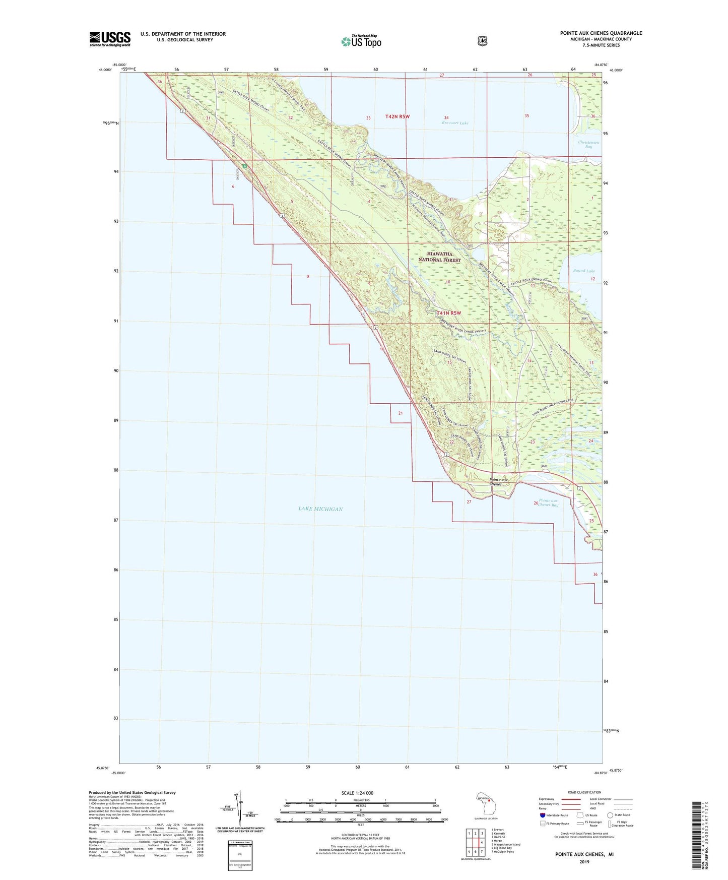
Pointe aux Chenes Michigan US Topo Map
Couldn't load pickup availability
Also explore the Pointe aux Chenes Forest Service Topo of this same quad for updated USFS data
2023 topographic map quadrangle Pointe aux Chenes in the state of Michigan. Scale: 1:24000. Based on the newly updated USGS 7.5' US Topo map series, this map is in the following counties: Mackinac. The map contains contour data, water features, and other items you are used to seeing on USGS maps, but also has updated roads and other features. This is the next generation of topographic maps. Printed on high-quality waterproof paper with UV fade-resistant inks.
Quads adjacent to this one:
Northwest: Brevort
North: Kenneth
Northeast: Ozark SE
East: Moran
Southeast: McGulpin Point
South: Big Stone Bay
Southwest: Waugoshance Island
This map covers the same area as the classic USGS quad with code o45084h8.
Contains the following named places: Brevoort Lake, Brevoort River, Christensen Bay, De Tour Union Presbyterian Church, Lake Michigan Campground, Pointe aux Chenes, Pointe aux Chenes Bay, Pointe aux Chenes River