MyTopo
Mecosta NW Michigan US Topo Map
Couldn't load pickup availability
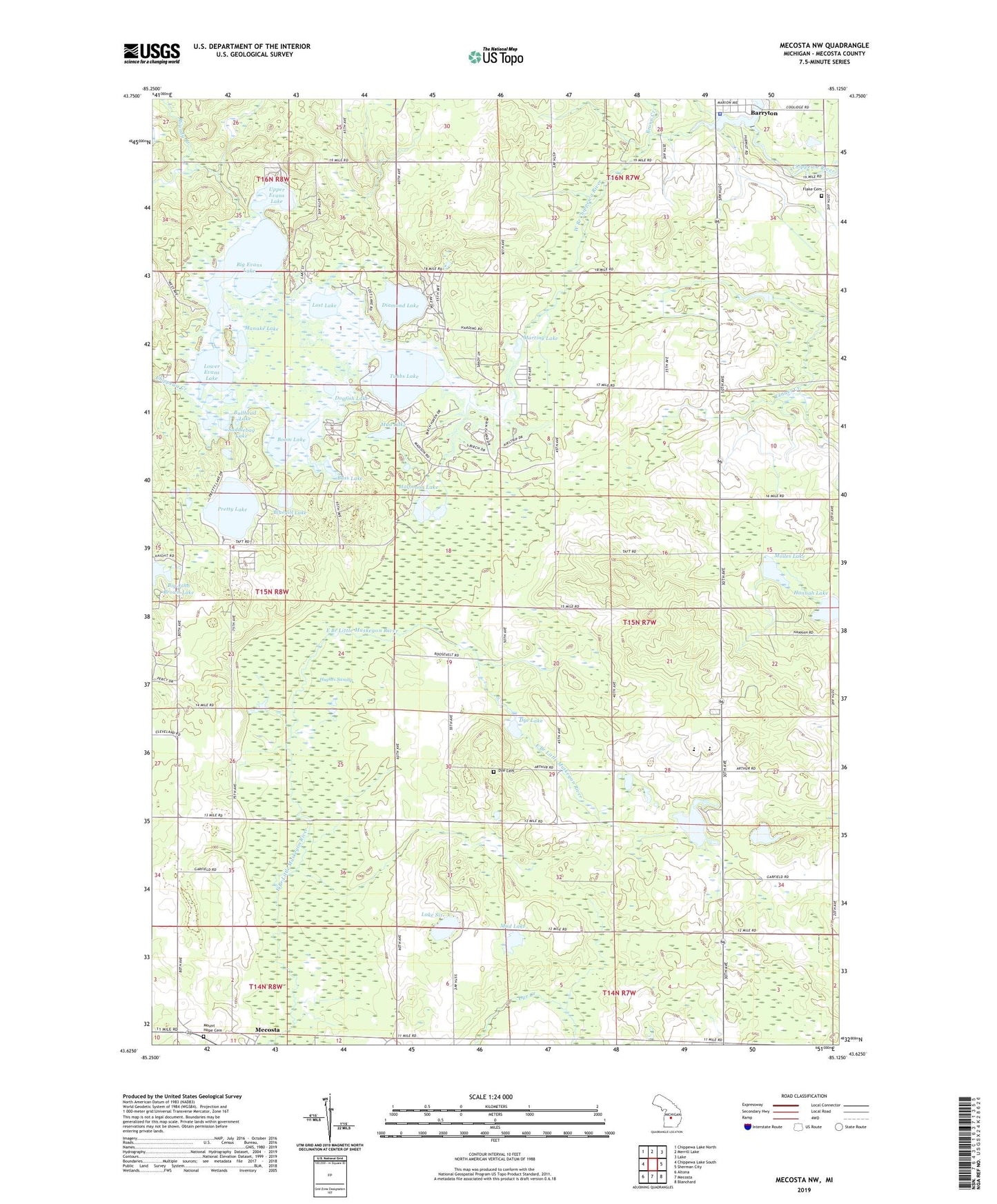
2019 topographic map quadrangle Mecosta NW in the state of Michigan. Scale: 1:24000. Based on the newly updated USGS 7.5' US Topo map series, this map is in the following counties: Mecosta. The map contains contour data, water features, and other items you are used to seeing on USGS maps, but also has updated roads and other features. This is the next generation of topographic maps. Printed on high-quality waterproof paper with UV fade-resistant inks.
Quads adjacent to this one:
West: Chippewa Lake South
Northwest: Chippewa Lake North
North: Merrill Lake
Northeast: Lake
East: Sherman City
Southeast: Blanchard
South: Mecosta
Southwest: Altona
Contains the following named places: Barryton Police Department, Bass Lake, Big Evans Lake, Big John Brown Lake, Blue Gill Lake Campground, Bluegill Lake, Boom Lake, Brown Creek, Bullhead Lake, Chippewa Creek, Chippewa Hills High School, Chippewa Hills Intermediate School, Church of Christ, Diamond Lake, Dogfish Lake, Dye Cemetery, Dye Creek, Dye Lake, Flake Cemetery, Halfmoon Lake, Hannah Lake, Helmer Creek, Holiday Terrace Mobile Home Park, Hughes Swamp, Jehovah's Witnesses Church, Lake Six, Lake Twentyeight, Lost Lake, Lower Evans Lake, Manake Lake, Martiny Lake, Martiny Lake State Game Area, Moiles Lake, Mount Hope Cemetery, Mud Lake, North Branch Chippewa River, Pine Grove Church, Pretty Lake, Remus Church of God, Roundy Branch, Saddlebag Lake, Sheridan Church, Stony Lake, Township of Sheridan, Tubbs Lake, Tubbs Lake State Forest Campground, United Methodist Church, Upper Evans Lake, West Branch Chippewa River, Wilson Lake, Winchester Dam