MyTopo
Chippewa Lake North Michigan US Topo Map
Couldn't load pickup availability
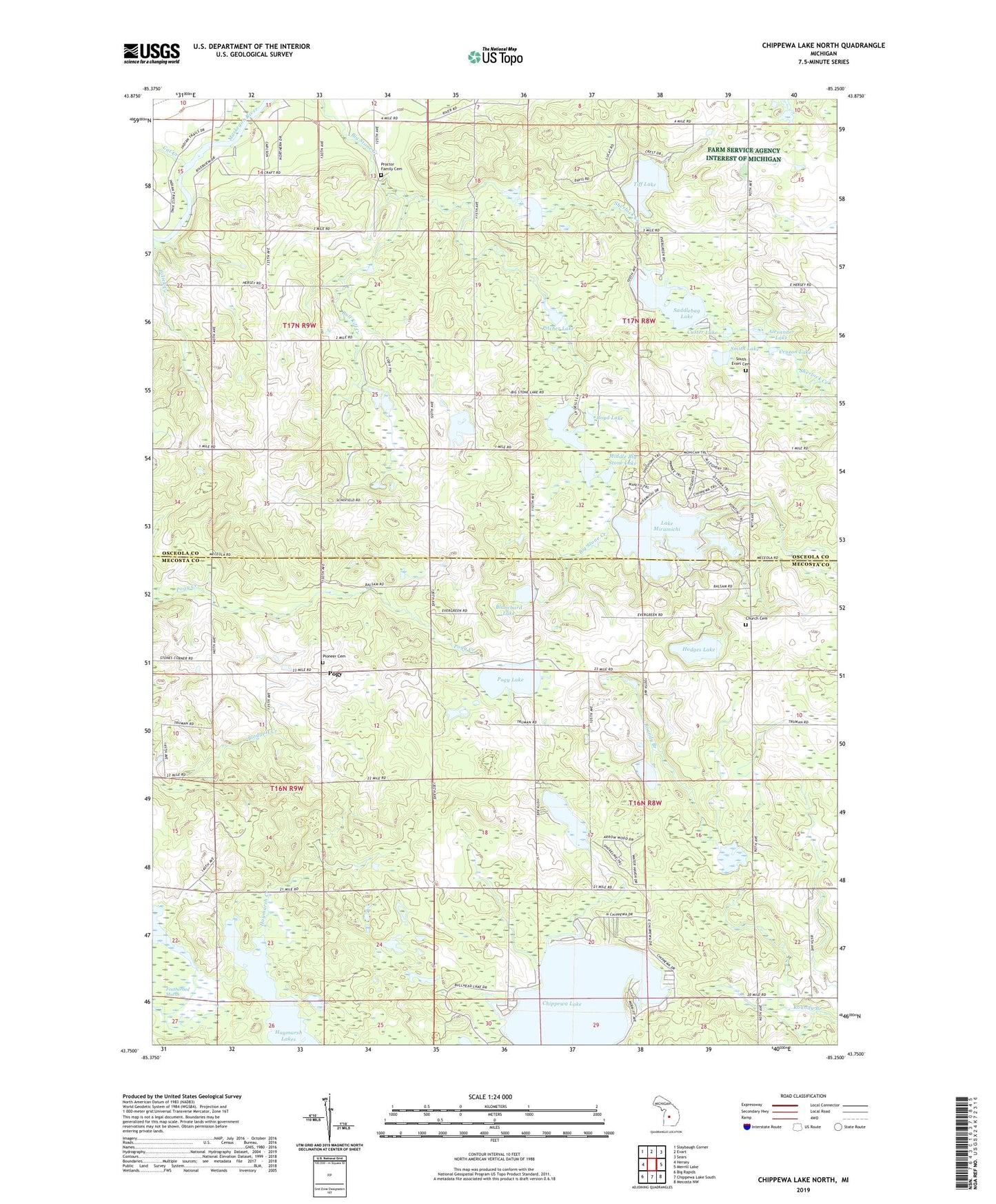
2023 topographic map quadrangle Chippewa Lake North in the state of Michigan. Scale: 1:24000. Based on the newly updated USGS 7.5' US Topo map series, this map is in the following counties: Mecosta, Osceola. The map contains contour data, water features, and other items you are used to seeing on USGS maps, but also has updated roads and other features. This is the next generation of topographic maps. Printed on high-quality waterproof paper with UV fade-resistant inks.
Quads adjacent to this one:
West: Hersey
Northwest: Slaybaugh Corner
North: Evart
Northeast: Sears
East: Merrill Lake
Southeast: Mecosta NW
South: Chippewa Lake South
Southwest: Big Rapids
This map covers the same area as the classic USGS quad with code o43085g3.
Contains the following named places: Alexander Lake, Blanchard Lake, Boyd Lake, Bull Kill Creek, Bullhead Lake, Cat Creek, Chippewa Lake, Church Cemetery, Cruzon Lake, Custer Lake, East Hersey Church, Featherbed Marsh, Haymarsh Creek, Haymarsh Lake State Game Area, Haymarsh Lakes, Hersey Mine, Hodges Lake, Lake Miramichi, Long Lake, Lower Big Stone Lake, Middle Big Stone Lake, Pecks Lake, Pine Lake, Pioneer Cemetery, Pitcher Lake, Pogy, Pogy Lake, Pogy Post Office, Polick Creek, Proctor Family Cemetery, Saddlebag Lake, Sherlock Creek, Smith Lake, South Evart Cemetery, South Evart Church, Tiff Lake, Township of Chippewa, Township of Evart, ZIP Code: 49320