MyTopo
Meredith Michigan US Topo Map
Couldn't load pickup availability
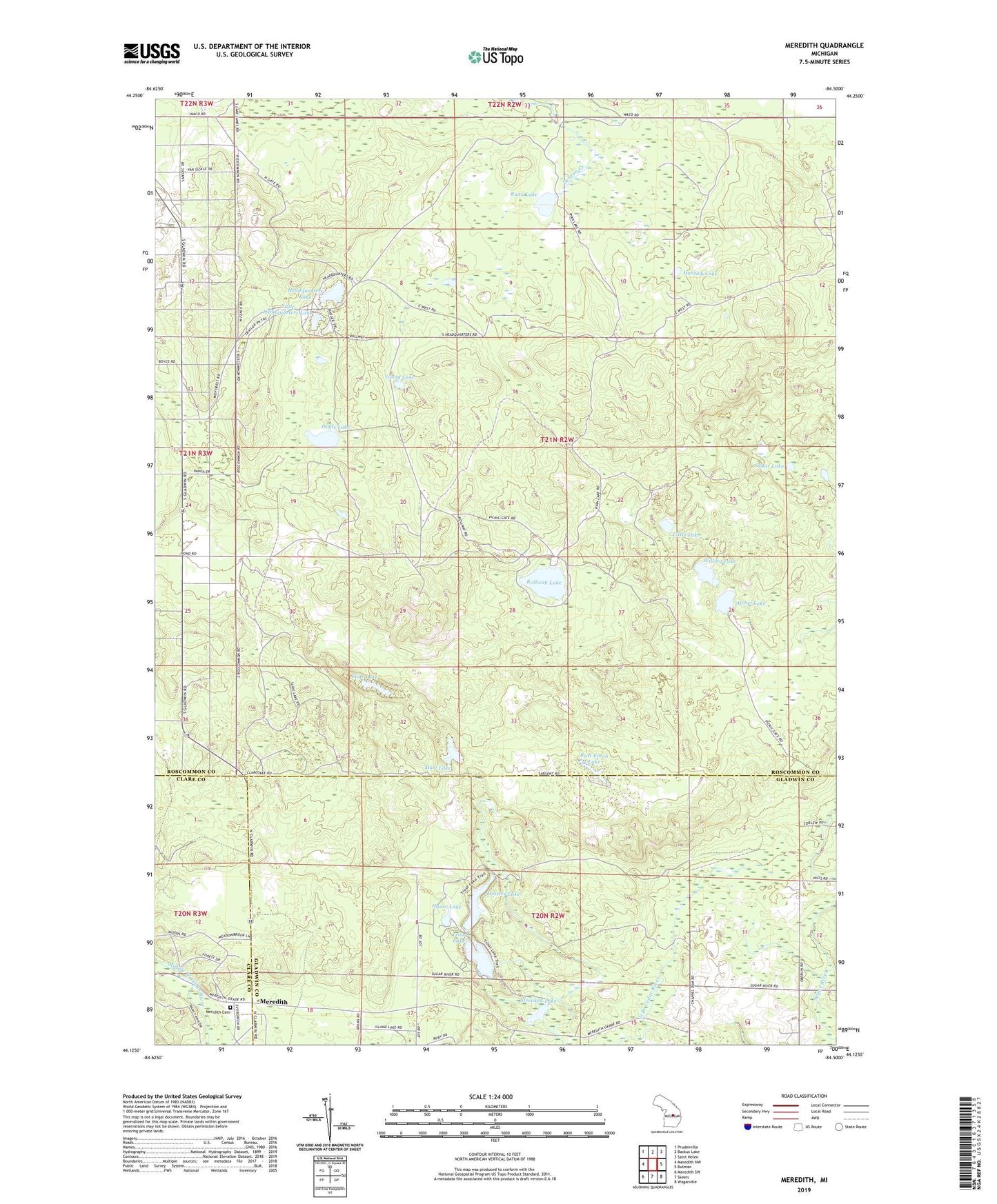
2023 topographic map quadrangle Meredith in the state of Michigan. Scale: 1:24000. Based on the newly updated USGS 7.5' US Topo map series, this map is in the following counties: Roscommon, Gladwin, Clare. The map contains contour data, water features, and other items you are used to seeing on USGS maps, but also has updated roads and other features. This is the next generation of topographic maps. Printed on high-quality waterproof paper with UV fade-resistant inks.
Quads adjacent to this one:
West: Meredith NW
Northwest: Prudenville
North: Backus Lake
Northeast: Saint Helen
East: Butman
Southeast: Wagarville
South: Skeels
Southwest: Meredith SW
This map covers the same area as the classic USGS quad with code o44084b5.
Contains the following named places: Achill Post Office, Atchel Lake, Beaver Lake, Doyle Lake, Headquarters Lake, Hoister Lake, House Lake, House Lake State Forest Campground, Huntley Lake, Leith Lake, Little Headquarters Lake, Little Lake, Marl Lake, Meredith, Meredith Post Office, Meridith Cemetery, Rollway Lake, Round Lake, Rust Eaton Lake, Ryan Lake, Slide Lake, Spruce Lake, Streaked Lake, Sugar Lake, Trout Lake, Trout Lake State Forest Campground, Willing Lake, Young Lake