MyTopo
Mesick NE Michigan US Topo Map
Couldn't load pickup availability
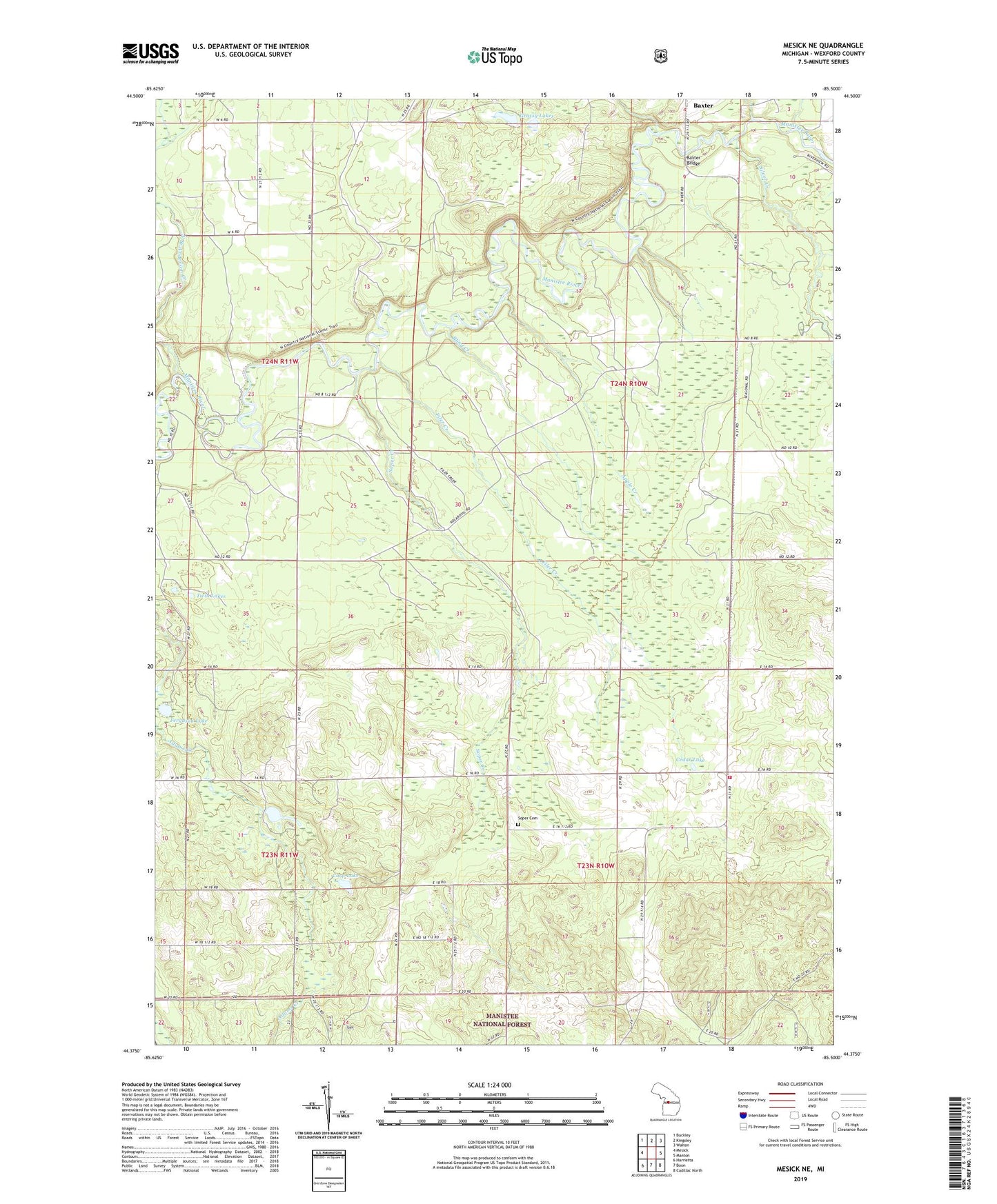
2019 topographic map quadrangle Mesick NE in the state of Michigan. Scale: 1:24000. Based on the newly updated USGS 7.5' US Topo map series, this map is in the following counties: Wexford. The map contains contour data, water features, and other items you are used to seeing on USGS maps, but also has updated roads and other features. This is the next generation of topographic maps. Printed on high-quality waterproof paper with UV fade-resistant inks.
Quads adjacent to this one:
West: Mesick
Northwest: Buckley
North: Kingsley
Northeast: Walton
East: Manton
Southeast: Cadillac North
South: Boon
Southwest: Harrietta
Contains the following named places: Anderson Creek, Apple Creek, Baxter Bridge, Baxter Bridge State Forest Campground, Blind Creek, Carp Lake, Cedar Lake, Colfax - Greenwood Volunteer Fire Department, Colfax Church, Ferguson Lake, Filer Creek, Grassy Lakes, Silver Creek, Soper Cemetery, Soper Creek, Township of Colfax, Township of Greenwood, Twin Lakes, Wheatland Post Office