MyTopo
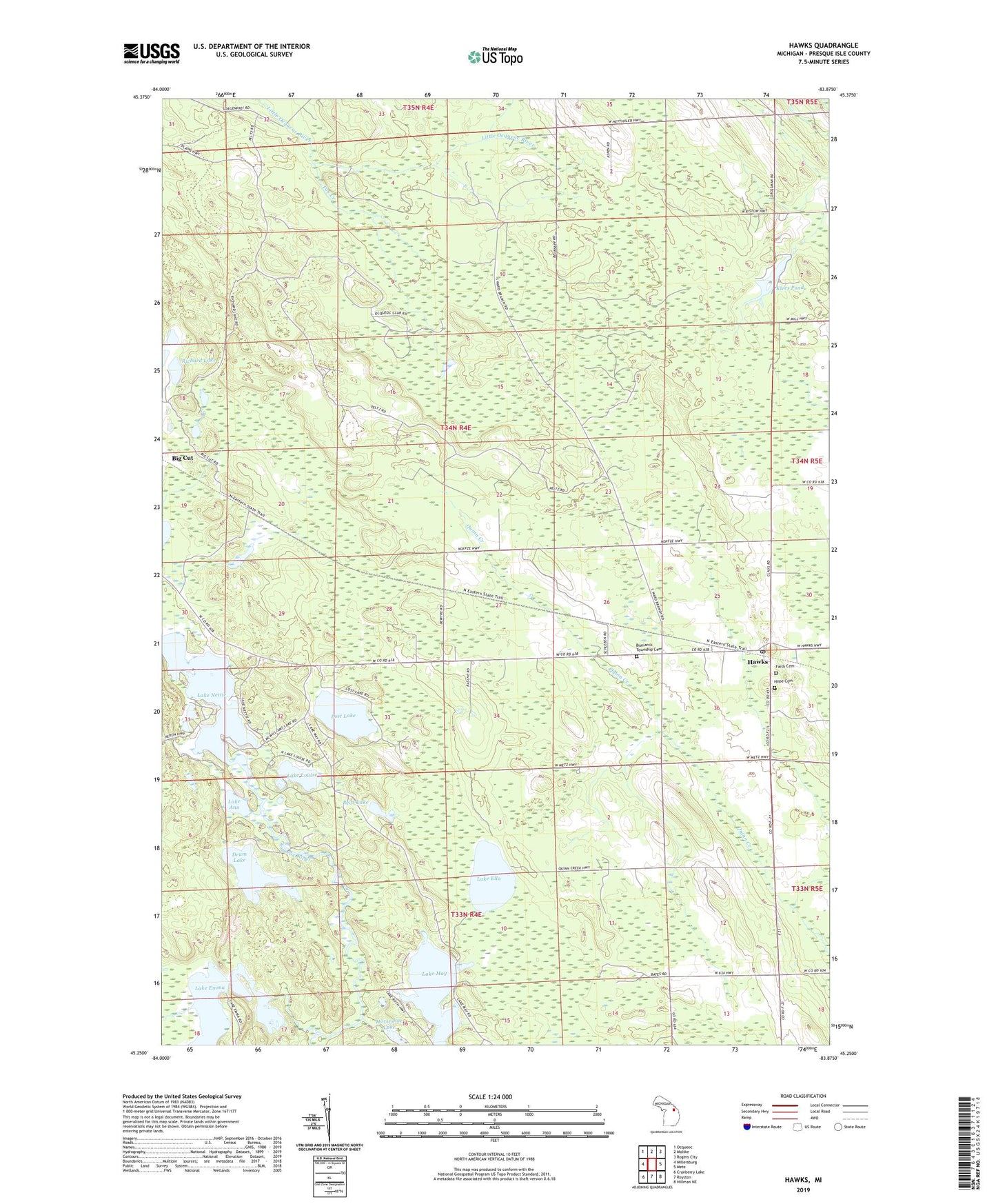
Hawks Michigan US Topo Map
Couldn't load pickup availability
2023 topographic map quadrangle Hawks in the state of Michigan. Scale: 1:24000. Based on the newly updated USGS 7.5' US Topo map series, this map is in the following counties: Presque Isle. The map contains contour data, water features, and other items you are used to seeing on USGS maps, but also has updated roads and other features. This is the next generation of topographic maps. Printed on high-quality waterproof paper with UV fade-resistant inks.
Quads adjacent to this one:
West: Millersburg
Northwest: Ocqueoc
North: Moltke
Northeast: Rogers City
East: Metz
Southeast: Hillman NE
South: Royston
Southwest: Cranberry Lake
This map covers the same area as the classic USGS quad with code o45083c8.
Contains the following named places: Bear Lake, Big Cut, Bismarck Township Cemetery, Drum Lake, Faith Cemetery, Faith Lutheran Church, Fox Creek, Hawks, Hawks Post Office, Hawks School, Hope Cemetery, Horseshoe Lake, Klees Pond, Lake Ann, Lake Ella, Lake Emma, Lake Louise, Lake May, Lake Nettie, Lake Wilson, Lost Lake, Richard Lake, Township of Bismarck, ZIP Code: 49743