MyTopo
Bellevue Michigan US Topo Map
Couldn't load pickup availability
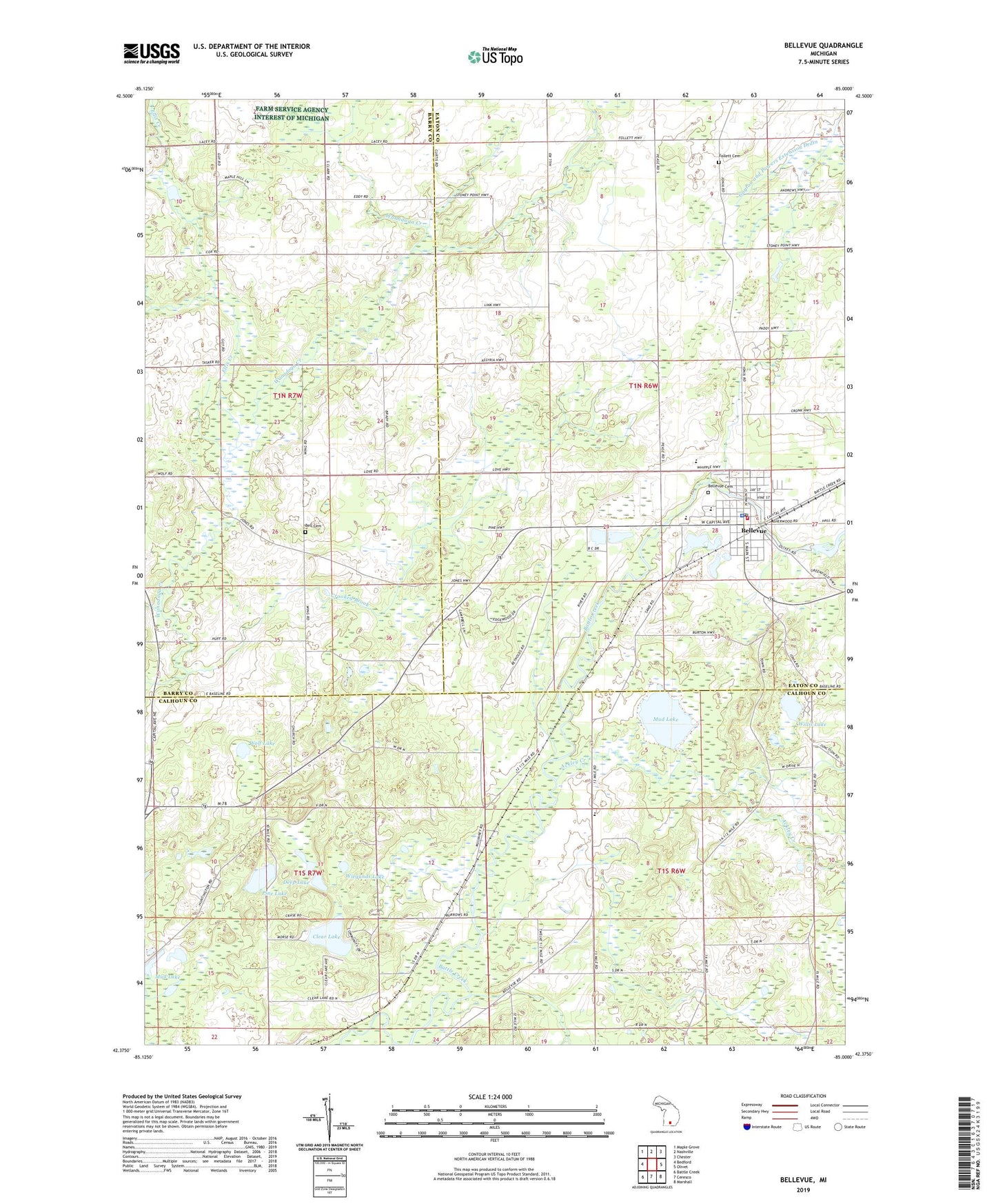
2023 topographic map quadrangle Bellevue in the state of Michigan. Scale: 1:24000. Based on the newly updated USGS 7.5' US Topo map series, this map is in the following counties: Calhoun, Eaton, Barry. The map contains contour data, water features, and other items you are used to seeing on USGS maps, but also has updated roads and other features. This is the next generation of topographic maps. Printed on high-quality waterproof paper with UV fade-resistant inks.
Quads adjacent to this one:
West: Bedford
Northwest: Maple Grove
North: Nashville
Northeast: Chester
East: Olivet
Southeast: Marshall
South: Ceresco
Southwest: Battle Creek
This map covers the same area as the classic USGS quad with code o42085d1.
Contains the following named places: Ackley Creek, Base Line Church, Bell Cemetery, Bellevue, Bellevue Christian Center, Bellevue Church of Christ, Bellevue Community Fire Department, Bellevue Elementary School, Bellevue First Baptist Church, Bellevue High School, Bellevue Middle School, Bellevue Mobile Home Park, Bellevue Police Department, Bellevue Post Office, Bellevue Riverside Cemetery, Bellevue Station, Bellevue Township Library, Bellevue United Methodist Church, Boughton School, Burleigh Corners, Ceylon Post Office, Charter Township of Pennfield, Clear Lake, Convis Post Office, Crooked Brook, Deep Lake, Ellis Creek, Follett Cemetery, Goose Lake, Little Goose Lake, Mud Lake, Pennfield School, Pine Lake, Saint Ann Catholic Church, Township of Bellevue, Township of Convis, Village of Bellevue, Wiegands Lake, Willis Lake, Wolf Lake, ZIP Code: 49021