MyTopo
Ozark NE Michigan US Topo Map
Couldn't load pickup availability
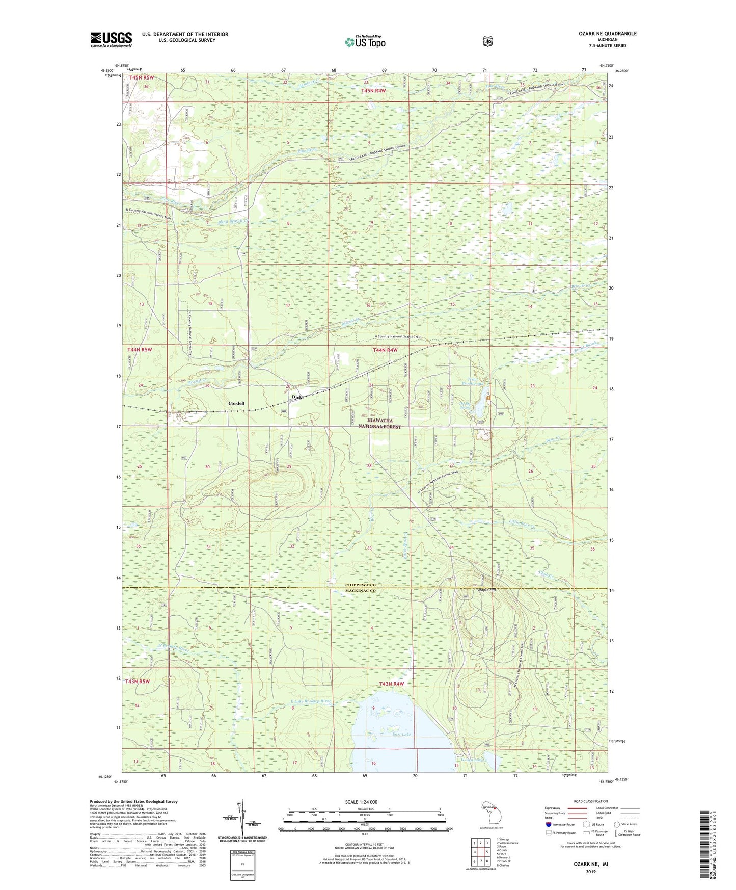
2019 topographic map quadrangle Ozark NE in the state of Michigan. Scale: 1:24000. Based on the newly updated USGS 7.5' US Topo map series, this map is in the following counties: Chippewa, Mackinac. The map contains contour data, water features, and other items you are used to seeing on USGS maps, but also has updated roads and other features. This is the next generation of topographic maps. Printed on high-quality waterproof paper with UV fade-resistant inks.
Quads adjacent to this one:
West: Ozark
Northwest: Strongs
North: Sullivan Creek
Northeast: Raco
East: Fibre
Southeast: Charles
South: Ozark SE
Southwest: Kenneth
Contains the following named places: Blind Biscuit Creek, Cordell, Dick, Dick Post Office, Dick Station, East Lake, East Lake Branch Carp River, Guard Lake, Haff Post Office, Hemlock Creek, Maple Hill, North Country Trail, Scott Quarry, The Big Spring, Trout Brook Pond, Trout Brook Pond Picnic Ground