MyTopo
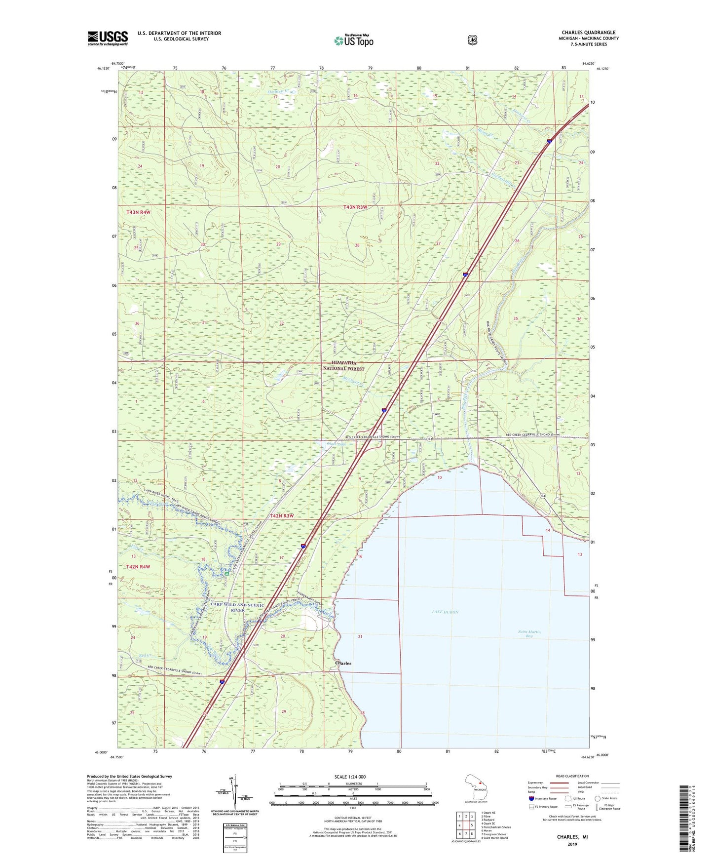
Charles Michigan US Topo Map
Couldn't load pickup availability
Also explore the Charles Forest Service Topo of this same quad for updated USFS data
2023 topographic map quadrangle Charles in the state of Michigan. Scale: 1:24000. Based on the newly updated USGS 7.5' US Topo map series, this map is in the following counties: Mackinac. The map contains contour data, water features, and other items you are used to seeing on USGS maps, but also has updated roads and other features. This is the next generation of topographic maps. Printed on high-quality waterproof paper with UV fade-resistant inks.
Quads adjacent to this one:
West: Ozark SE
Northwest: Ozark NE
North: Fibre
Northeast: Rudyard
East: Pontchartrain Shores
Southeast: Saint Martin Island
South: Evergreen Shores
Southwest: Moran
This map covers the same area as the classic USGS quad with code o46084a6.
Contains the following named places: Carp River, Carp River Campground, Charles, Charles Post Office, Flat Creek, Garden Hill Creek, Kingdom Hall of Jehovah's Witnesses, McCloud Creek, Pine River, Platz Lake, Red Creek, Township of Saint Ignace