MyTopo
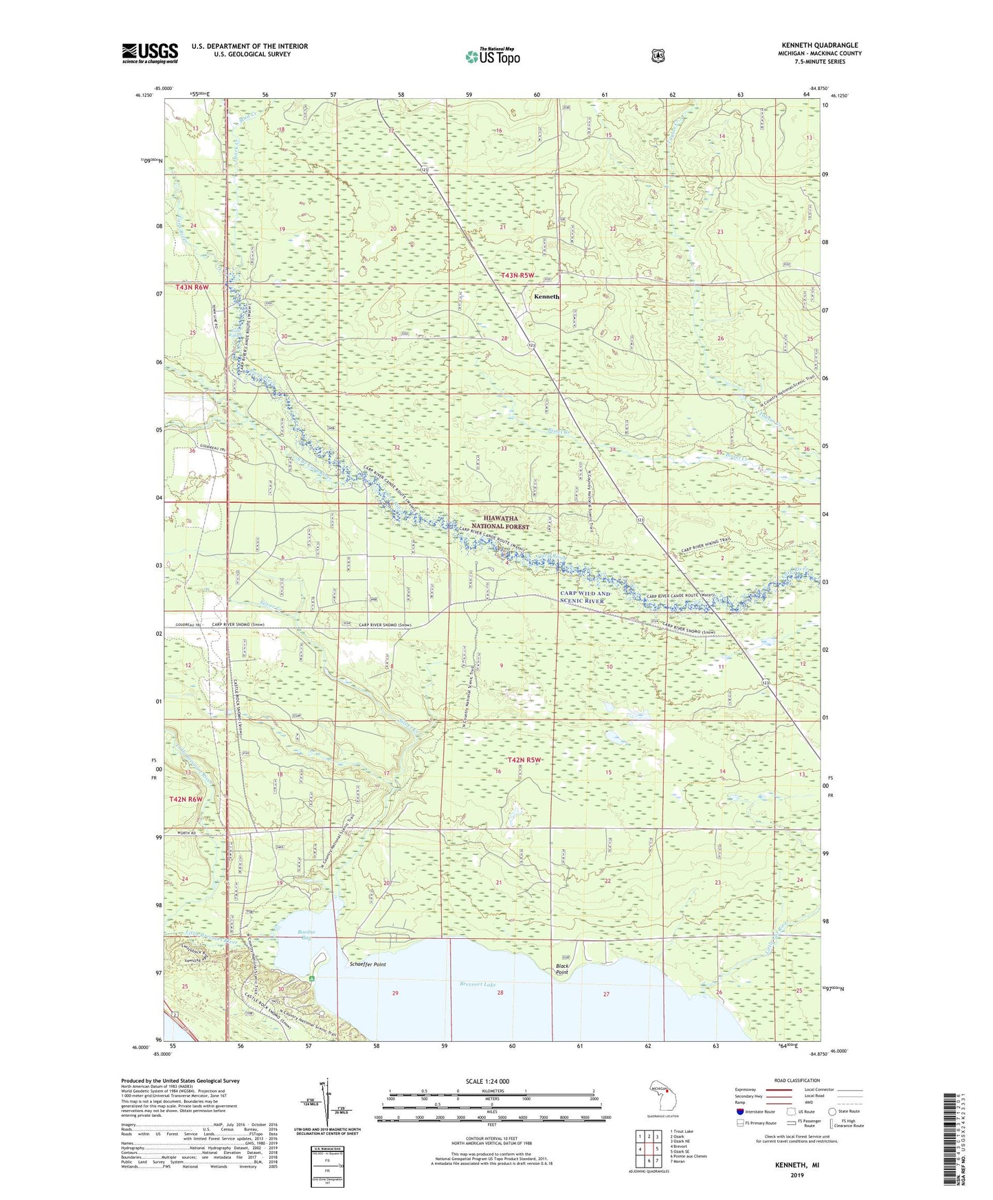
Kenneth Michigan US Topo Map
Couldn't load pickup availability
Also explore the Kenneth Forest Service Topo of this same quad for updated USFS data
2023 topographic map quadrangle Kenneth in the state of Michigan. Scale: 1:24000. Based on the newly updated USGS 7.5' US Topo map series, this map is in the following counties: Mackinac. The map contains contour data, water features, and other items you are used to seeing on USGS maps, but also has updated roads and other features. This is the next generation of topographic maps. Printed on high-quality waterproof paper with UV fade-resistant inks.
Quads adjacent to this one:
West: Brevort
Northwest: Trout Lake
North: Ozark
Northeast: Ozark NE
East: Ozark SE
Southeast: Moran
South: Pointe aux Chenes
This map covers the same area as the classic USGS quad with code o46084a8.
Contains the following named places: Black Point, Boedne Bay, Brevoort Lake Campground, Kenneth, Kenneth Post Office, Kenneth Station, Little Brevoort River, Little Cut River, Mud Creek, Ozark Creek, Rock Rapids, Schaeffer Point, Silver Creek, South Branch Carp River, Township of Moran, ZIP Code: 49760